A wonderful painting of the packhorse bridge captures the picturesque beauty of the Goyt Valley. It now spans the Goyt about a mile upstream, where it was moved in 1965.
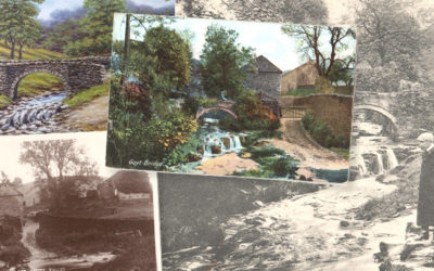
A wonderful painting of the packhorse bridge captures the picturesque beauty of the Goyt Valley. It now spans the Goyt about a mile upstream, where it was moved in 1965.
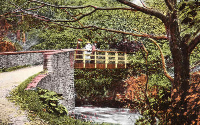
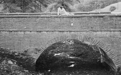
A photo captioned ‘View of footbridge over stream (possibly Goyt Valley) c.1854’ was a fascinating find. But identifying where it once stood wasn’t so easy. Could it have been the one over the Goyt at Taxal?
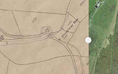
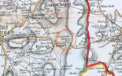
Alec has discovered a wonderful website that reveals a lot about the history of the Cheshire side of the Goyt Valley. Including the position of the second Stonyway Toll House.
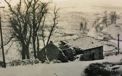
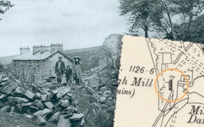
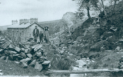
Another photo from the 1960s album shows Goyt’s Moss Farm in ruins. Which is odd as that this would mean it had been derelict for some 30 years. Perhaps the photo is earlier than I thought.
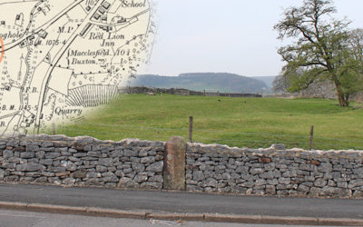
I don’t know whether it’s my failing eyesight, but I didn’t notice inscriptions on both the milestones on the Old Macclesfield Turnpike. But they were well-hidden.
This toll booth was one of five on the first Buxton to Macclesfield turnpike, forcing poorly-paid locals to pay a small tax for passing through the gates. Unsurprisingly, they were highly unpopular.
A writer in 1810 describes an ancient settlement close to Withinleach Farm. Today the farm is just a pile of stones beside the path to St. Joseph’s Shrine. It’s yet another Goyt Valley mystery.
An even older photo of Goytsclough shows the paint mill ruins in greater detail. It hopefully brings me one step closer to discovering where the giant waterwheel once stood.
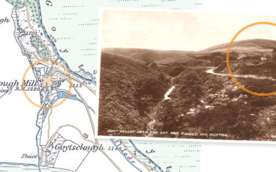
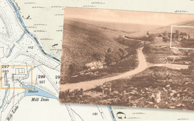
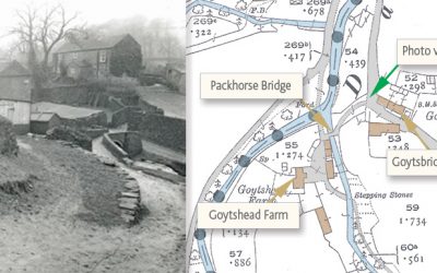
An old postcard of Goytsclough provides another small but tantalising clue in the puzzle over the giant waterwheel that once powered both the stone quarry and the later paint mill.
A new ‘then & now’ fade of one of my favourite old photos of the valley helps pinpoint exactly where the cottages at Goytsclough once stood. And it’s not where I thought!
Don asks about the foundations which lie just over the fence, coming down from the Long Hill road towards the Goyt Valley. I wonder whether it may once have been a toll house. But who knows?
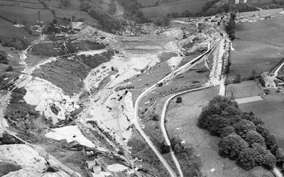
A 1934 aerial view of the Fernilee Reservoir construction site reveals some fascinating detail, including the ruins of the Gunpowder Mill, as well as the line of the old Cromford & High Peak Railway.
A new ‘then and now’ fade features one of my favourite photos of the Goyt Valley; Kathleen Nall collecting water at the natural spring outside her family home, Castedge Farm Cottage.
A newly-dicovered photo across the Goyt Valley dating back to the 1920s reveals some fascinating detail – Errwood Hall in the far distance and a possible ice cream kiosk beside Errwood Bridge.
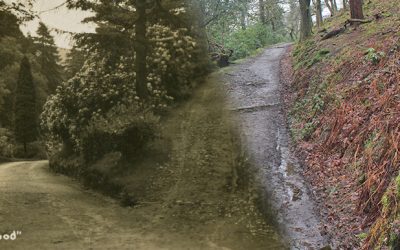
In 1880 a writer described “a footpath high above the carriage-way… a lovers’ walk; a deep-green wooded way made for Phillida and Corydon”. My thanks to James for pointing me in the right direction.
A rare view of Goyt’s Bridge, taken in the early 1930s, shortly before all the buildings were demolished following Stockport Corporation’s purchase of the valley to build the twin reservoirs.
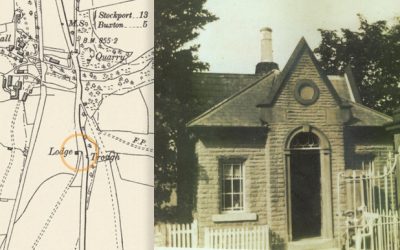
Gerald Hancock wrote ‘The Lodge’ on the back of this photo. But I’ve never been able to pinpoint where it was located. Could a lodge marked on an 1888 map of Fernilee provide the answer?
A recently discovered photo shows the bridge over the Bunsal Incline on the C&HP Railway in the late 1960s, shortly before the track was tarmacked to create the main route into the valley.
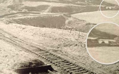
Trying to pinpoint the position of a section the C&HP Railway shown in an old photo posed a bit of a mystery. We think it might show a rare view of the track as it heads towards the valley.
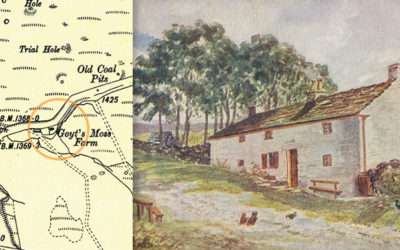
Goyt’s Moss Farm once lay beside the Macclesfield Old Road. It was completely rebuilt sometime after the 1930s and now serves as a Peak District National Park Rangers Information Centre.
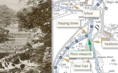
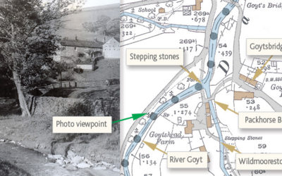
A rare postcard of the stepping stones at Goyt’s Bridge, probably taken around 1910. I hadn’t seen this view before and it reveals some wonderful detail of this most picturesque spot.
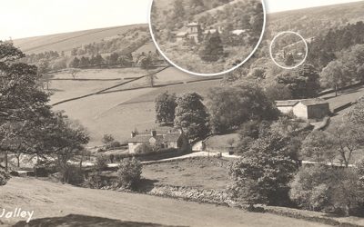
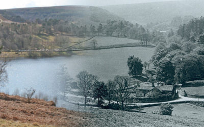
A scenic view across The Goyt towards Goytsbridge Farm in the distance. It’s one of a collection of photos of the valley taken in the early ’30s, shortly before the construction of the twin reservoirs.
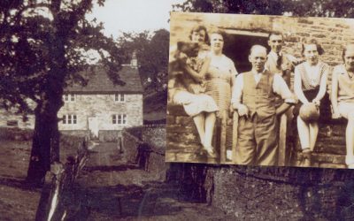
“I was going through some old photos dating to 1930/31 and there are several taken at Goyt Bridge. I have never been there myself but my father was involved with it at the time.”
I’ve tried to match an old photo of the small hamlet of Goyt’s Bridge with today’s scene across Errwood Reservoir, and merge one over the other. It’s not perfect, but it’s fairly close.
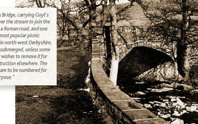
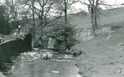
Goyt’s Bridge, carrying Goyt’s Lane over the stream and one of the most popular picnic places, will be submerged, unless some society wishes to remove it for reconstruction elsewhere…
The Goytsclough Paint Mills provided employment for around 20 people. Crushed baryte was packed in bags and taken by wagon to be loaded onto the High Peak Railway.
Stone from Goytsclough Quarry was used to pave both Regent Street and Oxford Street in London. Today, few signs remain of an industry created in the 17th century by the founder of Pickfords Removals.
“The photo shows a bridge over a stream but seemingly not Goyt’s Bridge. I can sort of remember it, it was a delightful place, the sort my parents sought out for picnics…”
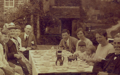
“Victorian visitors travelled many miles in their horsedrawn carriages, not just to see the wonderful Goyt Valley in summer, but to admire and enjoy the gardens with their variety and beauty. Then to take tea…”
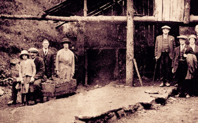
Old OS maps show a ‘Coal Pit’ between Errwood Hall and Castedge Farmhouse. The entrance to the mine has long since been blocked and is now covered by thick undergrowth.