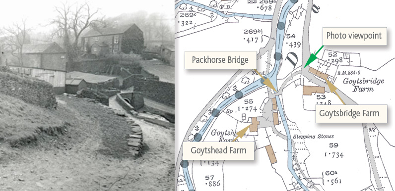
The green arrow shows the direction of view. Goytshead Farm is opposite, and was a popular spot for afternoon teas.
The packhorse bridge is below the farm, spanning Wildmoorestone Brook, just before it flows into the River Goyt.
The bridge survived until the mid ’60s, when it was dismantled and moved further upstream. Click here for more photos and information on the bridge.
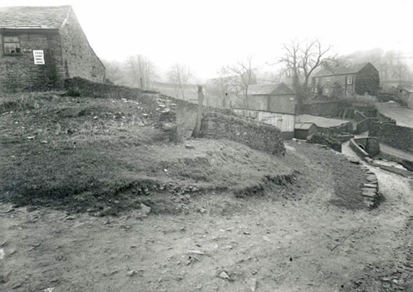
The photo was taken from Goyt’s Lane, with Goytsbridge Farm just out of the frame on the right, looking down towards the packhorse bridge. Goytshead Farm is top right.
It’s just possible to make out the word ‘Teas’ on the corner of the farm building on the left, with an arrow pointing left – presumably to an entrance door.
I know that teas were served to visitors at both farms (click for more information). But by the time this photo was taken, it looks like Goytsbridge Farm tearoom had moved to this building on the opposite side of Goyt’s Lane.
Derbyshire can be fairly drab and grey in winter. And this black and white view with its bare trees and muddy tracks doesn’t look like the kind of place to attract tourists.
Also, the photo would have been taken just before all the buildings were torn down. So there wouldn’t have been much incentive to keep it looking attractive for visitors.

This is an incredibly well made website, I love it.