Goyt Valley walks maps
I created these maps to fill the screen of a typical smart phone, which is why north points in different directions. Click any heading to view detailed step-by-step directions and photos, plus a short ‘Relive’ video. And please get in touch if you have a favourite walk you’d like to add. Or if you notice problems or mistakes with any particular walk.

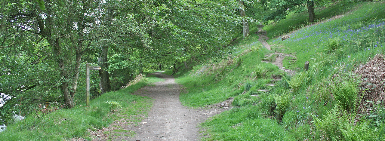
1: The Riverside
2 miles

2: Errwood Hall
1 mile

3: Valley views
1 mile

4: Errwood Hall & Shrine
3 miles

5: Whaley Bridge to Taxal
3 miles

6: Taxal Edge
6 miles

7: The rhododendrons
2 miles

8: Shining Tor
6 miles

9: Buxton to Errwood
8 miles

10: Old Goyt’s Lane
3 miles

11: Debyshire Bridge
3.5 miles

12: C&HP Railway
9 miles

13: Errwood Res. circular
5 miles

14: Fernilee Res. circular
4 miles

15: Errwood Goytsclough
5 miles

16: Fernilee woodland
3 miles

17: Foxlow Edge
1.5 miles

18: Fernilee west
3.5 miles

19: Axe Edge
7 miles

20: 3 Shires Head
5 miles

21: Buxton to Goyt
9.5 miles

22: Rainow to Lamaload
9.5 miles

23: Corbar to Errwood
8.5 miles

24: Fernilee Castle Naze
12 miles

25: Burbage Edge
7 miles

26: Windgather Rocks
11 miles

27: Railway track short
2 miles

28: Two reservoirs
8 miles

29: Joe Brown’s Nos. South
8.5 miles

29: Joe Brown’s Nos. North
11 miles
Hi. Is there a pub you would recommend nearby for either before or after the walk please? Got three young kids so thinking of the riverside walk. Thanks.
Are these walks ones I can let my dog off the lead?
Which is the driest under foot walk under 4 miles in the Goyt Valley,please?
Is there anywhere where you could leave the car overnight for a bit of wild camping, thanks.
Just completed the Fernilee Reservoir Circular, lovely walk! Which one of these walks would you recommend to get the best views across the valley? Great Website!
I would like to spend the day with my baby girl who is 9 month, in the Goyt Valley. Which walk would you recommend with a pram? Thank you very much!
Is there a booklet available for these walks?
Just wanted to say thank you. Followed your easy to understand instructions and had a lovely circular walk yesterday to the Three Shires.
I’m hoping to do a walk taking in Pym Chair and Shining Tor with my dog next week, but there seems to be a lot more waymarked foot paths on the you tube videos I’ve watched than there is marked on my OS White Peak Explorer map. Is there a map of these other trails available anywhere please?
Hi , Just seen these detailed photos and wondered if you could tell me if it would be possible to cycle the route please.
I think your walks are fabulous and I am so glad I found them. We have done 13 and 14 now. 13 was done last year in September on a beautiful sunny day and it was a stunning walk especially the little valley near the pack horse bridge. We sat here for a picnic and cooled off in the water. We did 14 yesterday after arriving to do 8 but it was cold and foggy so we didn’t think the views would be as good so we opted for 14 and what a lovely walk that was. We will go back and do 8 on another day but we do plan on working our way through all your walks. I find your instructions along with your videos really easy to follow and if we get lost we refer back to your instructions. Thank you for taking the time to put these together.
This is fabulous David. An area we sort of knew a bit (we’re from Leics) but your site has been really brilliant in helping us get to know it better. Thankyou. Hoping to do No.20 tomorrow!
So much hard work has clearly gone into this and my friends and I were the grateful beneficiaries over the weekend. We enjoyed number 26 very much. Thank you David for making it so straightforward.
Hi, which route would suit best to pick up a good stretch of old railway lines please?
First, excellent project. I wish there were more. I’m planning to come to the UK/Peak District sometime in October, and one day to do a walk in the Goyt Valley. Which route would you recommend to maximize best photo locations?