16. Fernilee Woodland Walk
A detailed, step-by-step description and map of this walk are available to download for just £1.85. A walking app GPX file is also available at £1.50. Save on both for just £2.95. All proceeds help cover the hosting costs of this website.
Walk description…
Length: 4.2mls
Av. time: 2.05hrs
Ascent: 794ft
Start: Bunsal Incline parking
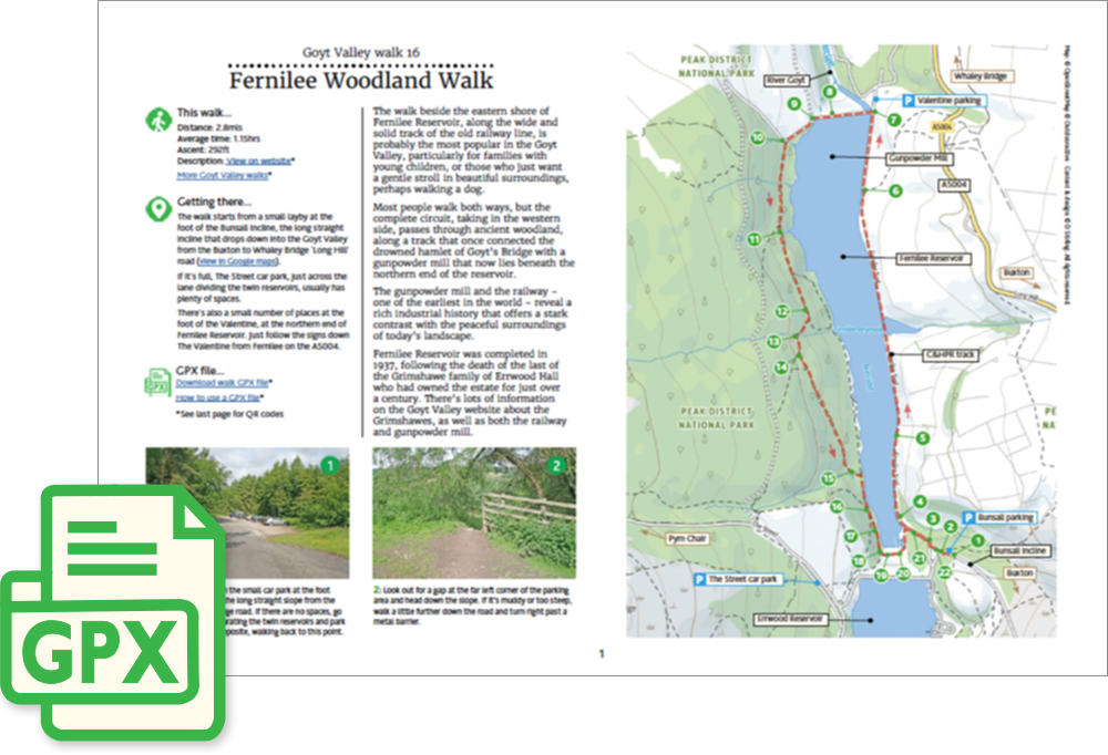
The walk beside the eastern shore of Fernilee Reservoir, along the wide and solid track of the old railway line, is probably the most popular in the Goyt Valley, particularly for families with young children, or those who just want a gentle stroll in beautiful surroundings, perhaps walking a dog.
Most people walk both ways, but the complete circuit, taking in the western side, passes through ancient woodland, along a track that once connected the drowned hamlet of Goyt’s Bridge with a gunpowder mill that now lies beneath the northern end of the reservoir.
The gunpowder mill and the railway – one of the earliest in the world – reveal a rich industrial history that offers a stark contrast with the peaceful surroundings of today’s landscape.
Fernilee Reservoir was completed in 1937, following the death of the last of the Grimshawe family of Errwood Hall who had owned the estate for just over a century. There’s lots of information on the Goyt Valley website about the Grimshawes, as well as both the railway and gunpowder mill.
‘Relive’ video…
Click to play. Click expand button to view in full screen.