21. Buxton to Goyt Valley
A detailed, step-by-step description and map of this walk are available to download for just £1.85. A walking app GPX file is also available at £1.50. Save on both for just £2.95. All proceeds help cover the hosting costs of this website.
Walk description…
Length: 9.3mls
Av. time: 4.15hrs
Ascent: 1476ft
Start: Buxton Pavilion Gardens car park
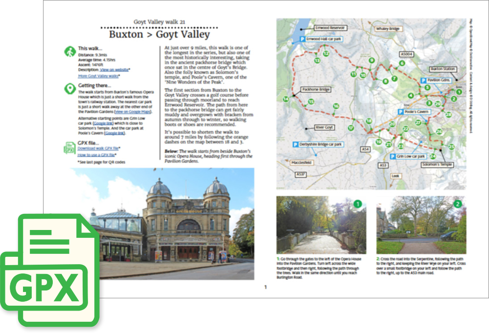
At just over 9 miles, this walk is one of the longest in the series, but also one of the most historically interesting, taking in the ancient packhorse bridge which once sat in the centre of Goyt’s Bridge. Also the folly known as Solomon’s temple, and Poole’s Cavern, one of the ‘Nine Wonders of the Peak’.
The first section from Buxton to the Goyt Valley crosses a golf course before passing through moorland to reach Errwood Reservoir. The path from here to the packhorse bridge can get fairly muddy and overgrown with bracken from autumn through to winter, so walking boots or shoes are recommended.
It’s possible to shorten the walk to around 7 miles by following the orange dashes on the map between 18 and 3.
‘Relive’ video…
Click to play. Click expand button to view in full screen.