9. Buxton to Errwood Reservoir
A detailed, step-by-step description and map of this walk are available to download for just £1.85. A walking app GPX file is also available at £1.50. Save on both for just £2.95. All proceeds help cover the hosting costs of this website.
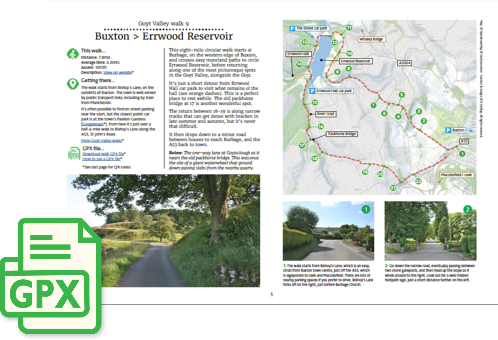
Walk description…
Length: 7.8mls
Av. time: 3.35hrs
Ascent: 1070ft
Start: Bishop’s Lane, Buxton
This eight-mile circular walk starts at Burbage, on the western edge of Buxton, passing along easy moorland paths to Errwood Reservoir, before returning to the starting point on Bishop’s Lane. It’s a fairly easy walk, with no steep slopes. But it can get muddy in places – particularly after rain – so walking boots are recommended.
It’s a pleasant 40-minute walk to the start point from Buxton Station, and there’s also a regular bus service which stops close to the start on St John’s Road. The nearest large car park is at the Pavilion Gardens, off Burlington Road (SK17 9AR) which is about a 20-minute walk away. There’s also limited off-road car-parking nearer the start.
Update #1: This walk is one of the most popular on the website. But a couple walking the route in September said the bracken was head-high at one point, which made the going a bit challenging. And there were also cows with calves in the field at the end of the walk which, although not aggressive, made them slightly nervous.
‘Relive’ video…
Click to play. Click expand button to view in full screen.