11. Derbyshire Bridge
A detailed, step-by-step description and map of this walk are available to download for just £1.85. A walking app GPX file is also available at £1.50. Save on both for just £2.95. All proceeds help cover the hosting costs of this website.
Walk description…
Length: 3.6mls
Av. time: 1.35hrs
Ascent: 492ft
Start: Derbyshire Bridge car park
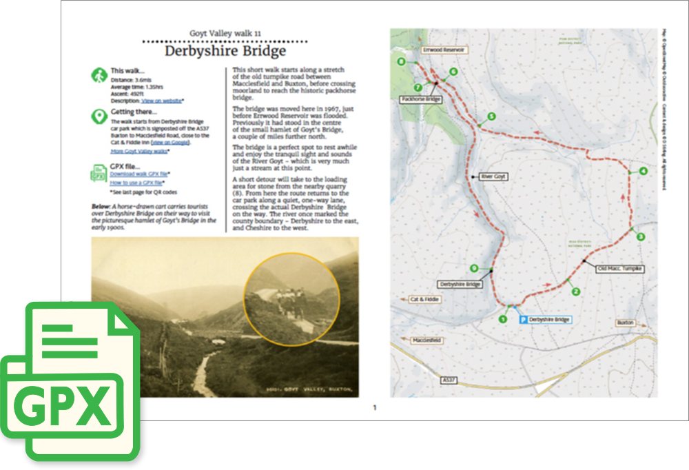
This short walk starts along a stretch of the old turnpike road between Macclesfield and Buxton, before crossing moorland to reach the historic packhorse bridge.
The bridge was moved here in 1967, just before Errwood Reservoir was flooded. Previously it had stood in the centre of the small hamlet of Goyt’s Bridge, a couple of miles further north.
The bridge is a perfect spot to rest awhile and enjoy the tranquil sight and sounds of the River Goyt – which is very much just a stream at this point.
A short detour will take to the loading area for stone from the nearby quarry (8). From here the route returns to the car park along a quiet, one-way lane, crossing the actual Derbyshire Bridge on the way.
The river once marked the county boundary – Derbyshire to the east, and Cheshire to the west.
‘Relive’ video…
Click to play. Click expand button to view in full screen.