Above: This photo, probably from the early 1900s, captures a lot of fascinating detail, including a horse-drawn cart coming towards the Cat & Fiddle which is just a short distance to the left, and a horse-drawn carriage heading towards Buxton.
It also shows the junction of the old and new Macclesfield roads, the old going down towards Goyt’s Moss, and the new on the right, which is now the A537.
I’ve often wondered about the history of the twin Buxton to Macclesfield roads that snake across this bleak landscape. One derelict and disused – apart from the odd walker. The other – the A537 – groaning under the weight of a never-ending stream of lorries and cars.
The two roads start fairly close to each other in Burbage, on the outskirts of Buxton. And run in rough parallel before coming together at the Cat & Fiddle, and then separating again.
It seems such a massive waste of resources to build twin roads between the two towns, and within a relatively short space of time. I turned to Alan Robert’s ‘Turnpike Roads of Buxton’ to see if I could discover the facts.
Alan explains that turnpikes were introduced across the country in the early 18th century to improve England’s fast-disintegrating roads. New roads were built and maintained by collecting a small payment from those using them. And tollgates (or turnpikes) were placed at regular intervals to collect the tax.
Buxton to Manchester Turnpike
Derbyshire’s very first turnpike ran north, connecting Buxton to Manchester, which was vital for local trade. An Act in 1725 set out the pressing need for improving the road, describing it as…
“…very ruinous, and many parts thereof almost impassable in the winter season, and in divers places so narrow, that it is becoming dangerous to persons passing though the same.”
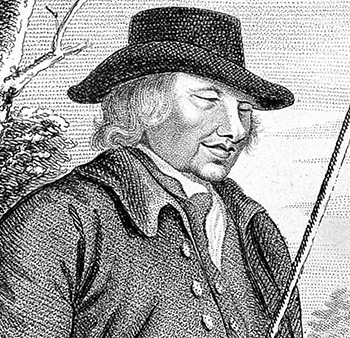
Above: ‘Blind Jack’ Metcalfe (1717-1810) was a larger than life character – 6’2″ tall and blind since catching smallpox at just one year old.
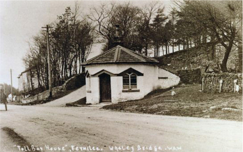
Above: A rare photo of the toll house which once stood on the Manchester to Buxton Turnpike at Fernilee, just to the east of Whaley Bridge (click to enlarge).
The first stage was to improve the existing Roman road which ran through the Wainstones (see this post). This would have been in the mid 1720s.
The famous ‘Blind Jack of Knaresborough’ later created a new route to the west of the Roman road in the 1770s. He was a highly colourful character who coped amazingly well with his blindness. (Someone recently told me that Blind Jack also constructed the first Buxton to Macclesfield Turnpike, but Alan says this isn’t correct.)
In another 50 years, around 1820, this road was altered to avoid some of the steep inclines on Blind Jack’s original route, creating the modern A5004 ‘Long Hill’ road. One of these steps sections is clearly visible on the right when approaching the turn-off to the Goyt Valley from Fernilee.
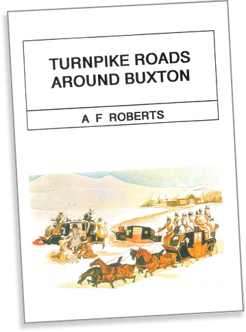
Above: Alan’s book, Turnpike Roads Around Buxton, is available from High Peak Bookstore at Brierlow Bar.
Buxton to Macclesfield Turnpike
In 1759 a Macclesfield solicitor was asked to report to the House of Lords on the condition of the road to the west of Buxton – to Macclesfield. This ran past the source of the River Goyt, and close to the Cat & Fiddle…
They are very bad and boggy and I can venture to say that the greatest part of them are the worst roads in the King’s dominions, as far as I have seen.
Much of the Buxton to Macclesfield route went through the Duke of Devonshire’s land. He was a keen supporter of the turnpike as it improved transport links between his lime kilns at Grinlow, on the slopes beneath where Solomon’s Temple stands today, and his coal fields at Goyt’s Moss. It also made it far easier and less expensive to transport lime to Macclesfield and beyond.
The original route was completed in 1759. But it soon became clear that the long stretches of steep road were unsuited to the increasing weight of horse-drawn wagons. And in 1815 the turnpike trustees presented plans for an alternative route with less inclines, which was completed in 1823.
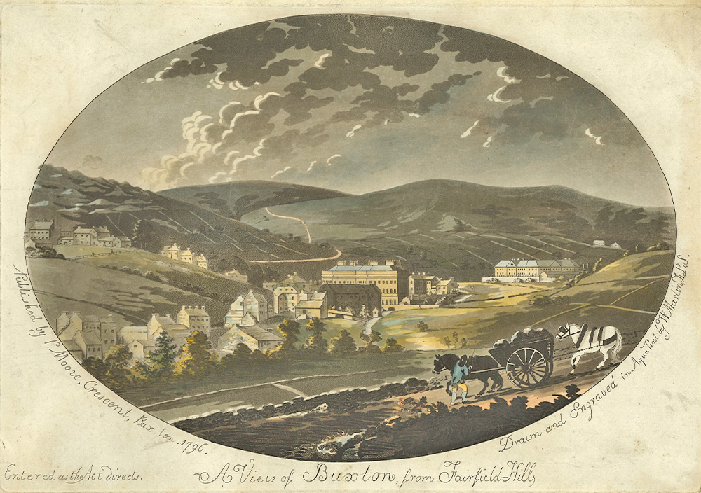
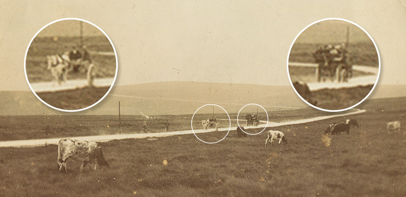
Above: The complete engraving; A view of Buxton from Fairfield, 1796. Drawn and engraved by W. Martin and published by R, Moore, The Crescent, Buxton. Reproduced with permission from Buxton Museum and Art Gallery, Derbyshire County Council’. (Click to enlarge.)
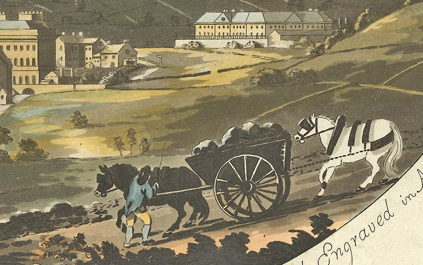
Above: This detail from a hand-coloured engraving shows a collier struggling to bring his heavy load of coal to Buxton in 1796 (click to enlarge). With one horse in front and another behind, it illustrates the problem of using horse-drawn carts down steep slopes. And as the carts got larger, so did the problem.
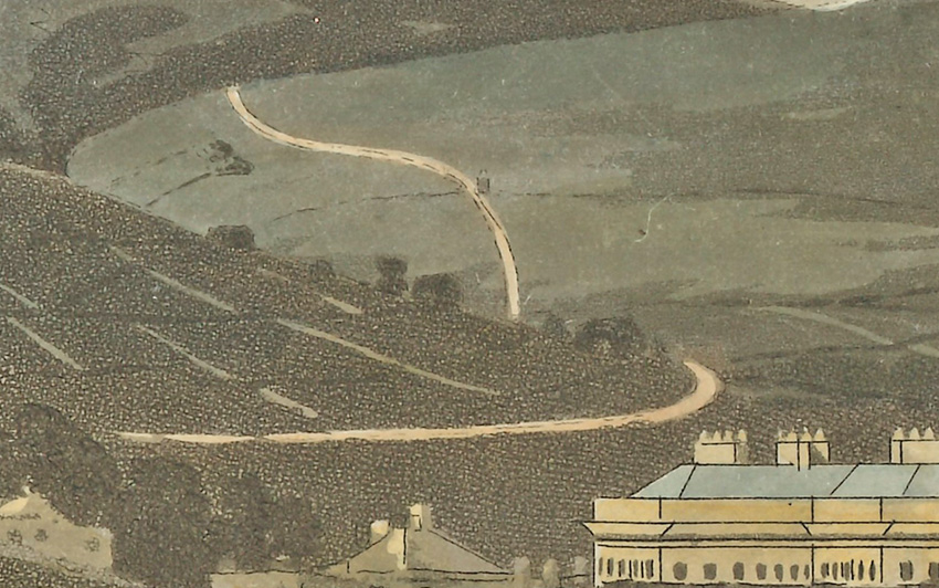
Above: In the background, it’s just possible to make out the first Buxton to Macclesfield Turnpike snaking over the horizon. And even what looks to be a tollhouse half way up the slope (click to enlarge).
The coming of the railways during the 19th century spelled the end of the turnpike system. The Turnpike Trusts were no longer able to attract investment, and many fell into bankrupcy.
The Buxton to Manchester Macclesfield Turnpike closed in 1872, and the Buxton to Macclesfield in 1878.
The end of the turnpikes
There’s an interesting chapter in Alan’s book describing the end of the turnpikes in and around Buxton. Click here to read it.

The toll house shown on the second picture is probably Gosling Bar – no.43 on p.56 of Turnpike Roads around Buxton.
We live in Walker Barn, Macclesfield. Does anyone have any maps of the area, dating before the tithe maps of 1837? Much appreciated to see any, if anyone has one.