Two very weathered and roughly-carved religious phrases on the old Roman road lying close to the Goyt Valley could date back to when it was improved under a Turnpike Law passed in 1725.
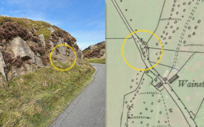
Two very weathered and roughly-carved religious phrases on the old Roman road lying close to the Goyt Valley could date back to when it was improved under a Turnpike Law passed in 1725.
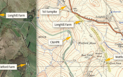
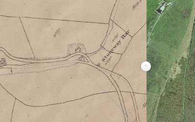
Many theories have been proposed for the mysterious, mile-long earthwork between Watford and Longhill Farms. Was it for a large gun, a railway test track, or perhaps an abandoned turnpike extension?
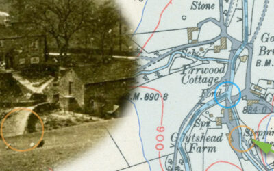
A 1918 photo taken from Goyt’s Lane towards Goytshead Farm comes frustratingly close to revealing a second set of stepping stones close to the packhorse bridge in Goyt’s Bridge.
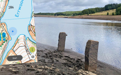
The second part of my attempts to trace features that have emerged during the recent drought; a pair of sturdy gateposts and a junction of lanes, all of which have been hidden since Errwood was flooded.
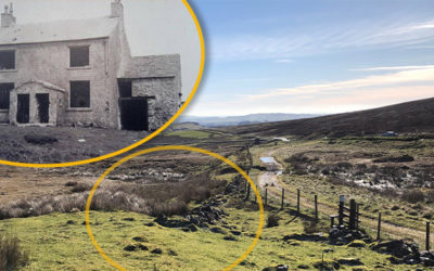
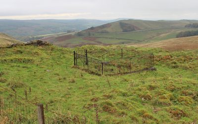
A photo of a derelict building known as Boothman’s Cottages recently came to light. There’s nothing left of it today. Was it connected to coal mining, or simply a stop-off point for weary travellers?
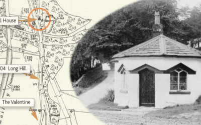
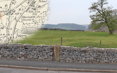
Fernilee Toll House once stood beside the Long Hill Road between Buxton and Whaley Bridge. Today, there’s very little sign this attractive building ever existed. Which is a great shame.
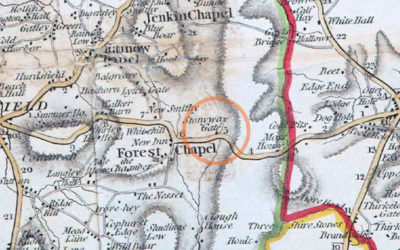
Alec has discovered a wonderful website that reveals a lot about the history of the Cheshire side of the Goyt Valley. Including the position of the second Stonyway Toll House.
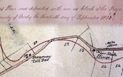
After much discussion on the Goyt Valley Facebook Group, we think we’ve finally nailed down where the first Stonyway Toll Booth once stood. But where it was moved to is still a mystery!
I don’t know whether it’s my failing eyesight, but I didn’t notice inscriptions on both the milestones on the Old Macclesfield Turnpike. But they were well-hidden.
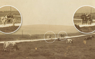
This toll booth was one of five on the first Buxton to Macclesfield turnpike, forcing poorly-paid locals to pay a small tax for passing through the gates. Unsurprisingly, they were highly unpopular.
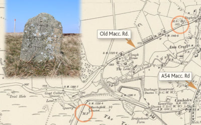
A recent talk in Buxton on milestones inspired me to go in search of any of these small roadside markers that lie close to the Goyt Valley, alongside the old turnpikes.
I’ve often wondered about the history of the old and new Buxton to Macclesfield roads that snake in tandem across the windswept moors. One now derelict, the other today’s A537.
Don asks about the foundations which lie just over the fence, coming down from the Long Hill road towards the Goyt Valley. I wonder whether it may once have been a toll house. But who knows?