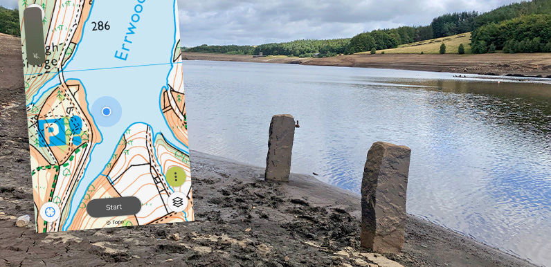
Above: A screengrab from my phone shows where I was standing when I took the photo of the twin gateposts.
The sturdy gateposts that recently appeared above the surface of Errwood Reservoir lie on the opposite bank to those featured in the previous post and are a bit of a mystery.
I’ve plotted their position on the old map on the fade below. They stood between the lane from Goytsclough to Goyt’s Bridge and the River Goyt, which was just a few feet away on the right, down a fairly steep slope. So it’s difficult to understand what purpose they served.
Click the ‘Now’ button to fade between this map from around 1890 and today’s satellite view to see how the hamlet of Goyt’s Bridge vanished beneath the waters of Errwood Reservoir.
I’ve circled the position of the gateposts, as well as a junction of roads a short distance to the south.

This photo, probably dating to the early 1930s, was taken slightly north of the gateposts – near where a spring is marked on the old map – with the Goyt on the right and Goytsbridge Farm in the distance. The packhorse bridge – which now spans the Goyt at Goytsclough – is just out of view below the farmhouse.

This was taken looking south, along the old, tarmacked road to Goytsclough and Derbyshire Bridge, with the Goyt on the left. This shows the size of the river before the construction of Errwood Reservoir in the mid 1960s.
It was still little more than a stream, and would have provided wonderfully picturesque views to anyone coming along the lane. The road divides just out of view on the far right of the photo.
The main section on the left rises up to join today’s one-way road to Goytsclough and Derbyshire Bridge a short distance further.

This photo shows the untarmacked track sloping up and around to the right. I’ve circled the junction of the road and the track on the fade below. Clicking the ‘Now’ button reveals that it once led up to the road connecting Errwood Hall and Goytsclough, and then formed a ‘holloway’, going further up the hillside towards the Cat & Fiddle and the Buxton to Macclesfield turnpikes.
Holloways were formed before the construction of roads by packhorses and travellers compacting the ancient routes that once criss-crossed the country. (Click here for posts on other holloways in and around the valley.)
By the time the old map on the fade was published in the 1890s, the holloway had fallen out of use and wasn’t marked. But it’s still just visible on the satellite view, lying a short distance to the south of today’s footpath up to Stakeside.
I’ve tried to follow it but the top section is on the other side of a barbed-wire fence and in fairly dense woodland. The ‘Relive’ below records my efforts on a damp and grey morning when the water level in Errwood was still very low.
