Two very weathered and roughly-carved religious phrases on the old Roman road lying close to the Goyt Valley could date back to when it was improved under a Turnpike Law passed in 1725.
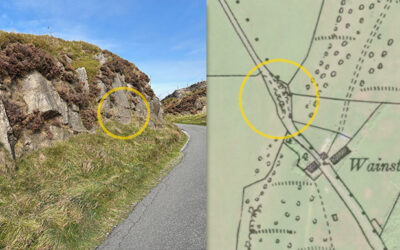
Two very weathered and roughly-carved religious phrases on the old Roman road lying close to the Goyt Valley could date back to when it was improved under a Turnpike Law passed in 1725.
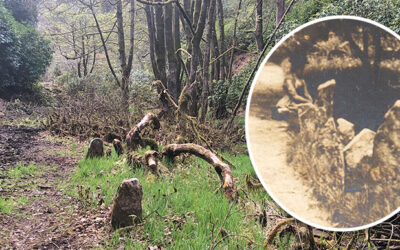
Forestry England has recently been clearing undergrowth from the old drive leading from Goyt’s Bridge to Errwood Hall, and it’s revealed some intriguing features alongside Shooters’ Clough.
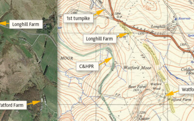
Many theories have been proposed for the mysterious, mile-long earthwork between Watford and Longhill Farms. Was it for a large gun, a railway test track, or perhaps an abandoned turnpike extension?
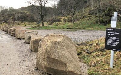
Forestry England has recently closed off the popular parking areas at Goytsclough with a long row of large boulders in an attempt to stop what they call ‘antisocial behaviour’.
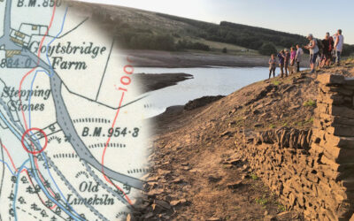
A photo taken back in late August 2022, when the water level in Errwood Reservoir dropped significantly, revealed the path running down to the second set of stepping stones.
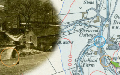
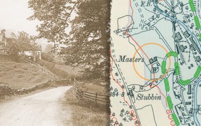
A 1918 photo taken from Goyt’s Lane towards Goytshead Farm comes frustratingly close to revealing a second set of stepping stones close to the packhorse bridge in Goyt’s Bridge.
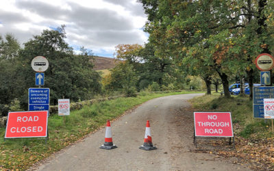
The narrow, one-way road between Errwood Hall car park and Derbyshire Bridge has been closed until December 1st – or earlier if Forestry England manage to complete their tree-felling sooner.
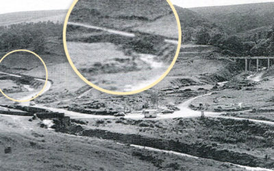
A grainy photo taken shortly before Errwood Reservoir was flooded in 1968 seems to solve the mystery of the sturdy gateposts that have recently surfaced during the drought of August 2022.
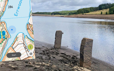
The second part of my attempts to trace features that have emerged during the recent drought; a pair of sturdy gateposts and a junction of lanes, all of which have been hidden since Errwood was flooded.
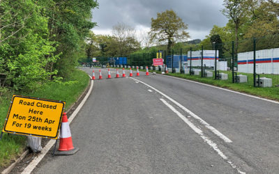
The closure of a long section of Long Hill is frustrating for motorists, but has hit the Goyt Valley’s closest pub particularly hard. New tenant, Leon, has already seen takings down by two-thirds.
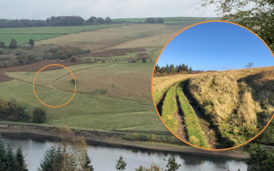
The felling of the fir trees above Fernilee has opened up some wonderful views across the valley. I was curious about some tracks running up from the path along the opposite side of the reservoir.
The road through the Goyt valley was described as “one of the loveliest in Derbyshire”. But Mrs Grimshawe once closed it due to the “disgraceful conduct of a char-a-banc party”!
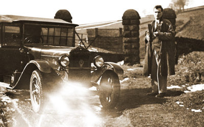
A recently discovered photo from the 1930s seems to show Old Goyt’s Lane, and prove that cars were capable of tackling what seems a steep and difficult road. Or did it?
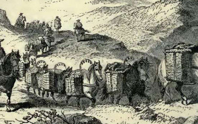
Teams of up to 40 sturdy packhorses came through Goyt’s Bridge, carrying everything from salt and coal to stone and cloth. But even small rivers could prove a serious hazard…
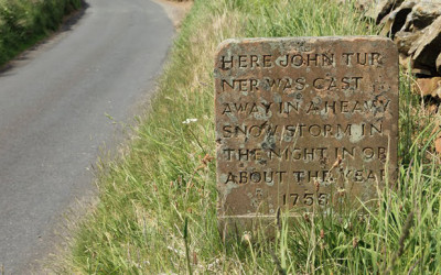
A mile or two southwest of Jenkin Chapel stands an intriguing stone memorial to John Turner. But who was the mysterious lady who left a single footprint beside his frozen body?