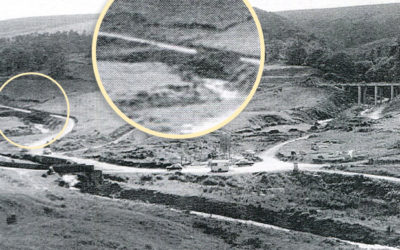
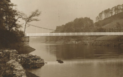
A recently discovered 1945 aerial photo of the southern tip of Fernilee Reservoir captures the metal suspension bridge which was removed in the mid ’60s, shortly before Errwood was flooded.
A recently discovered 1945 aerial photo of the southern tip of Fernilee Reservoir captures the metal suspension bridge which was removed in the mid ’60s, shortly before Errwood was flooded.
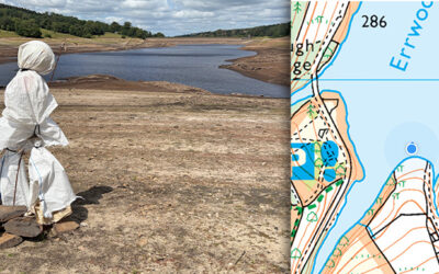
The ghostly figure of Bob looks out across Errwood Reservoir as the water level continues to drop dramatically. Will he be first to see Errwood Bridge appear above the surface. Time will tell…
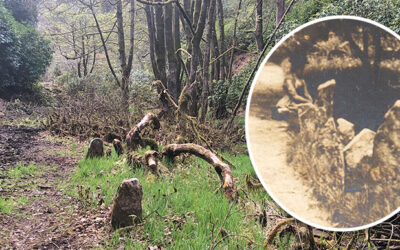
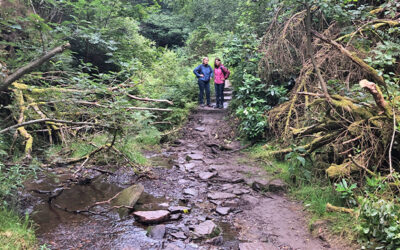
Forestry England has recently been clearing undergrowth from the old drive leading from Goyt’s Bridge to Errwood Hall, and it’s revealed some intriguing features alongside Shooters’ Clough.
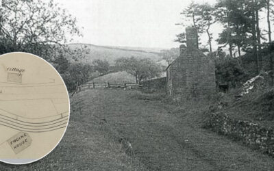
A grainy photo of a building half-way down the Bunsall Incline has always intrigued me. A recently discovered map from around 1855 shows it marked as a cottage, lying opposite a long-lost engine house.
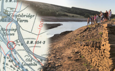
A photo taken back in late August 2022, when the water level in Errwood Reservoir dropped significantly, revealed the path running down to the second set of stepping stones.
The mystery of the vanished footbridge along the path around the ruins of Errwood Hall deepens. I’m just hoping Forestry England will replace it. But their silence makes me fear for the worst.
An 1845 tithe map shows that Errwood Hall hadn’t yet been built, even though Samuel Grimshawe purchased the land some 13 years earlier. I thought work had started well before then.
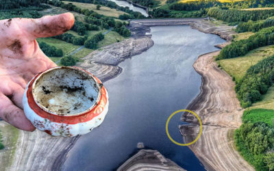
A spot near the reduced waterline may once have been a midden where rubbish from Goytsbridge Farm was dumped. Most of it is of little interest, but a few attractive items have been found.
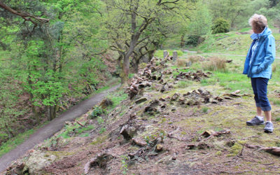
Yet more stone features are appearing above the surface of Errwood Reservoir. The four nearest the bank could have been part of the large twin barns which stood beside the lane to Errwood Hall.
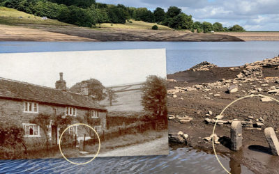
A grainy photo taken shortly before Errwood Reservoir was flooded in 1968 seems to solve the mystery of the sturdy gateposts that have recently surfaced during the drought of August 2022.
The second part of my attempts to trace features that have emerged during the recent drought; a pair of sturdy gateposts and a junction of lanes, all of which have been hidden since Errwood was flooded.
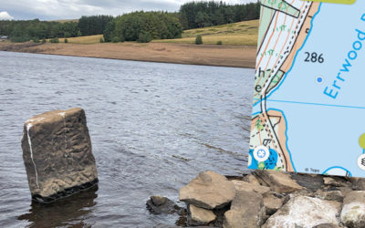
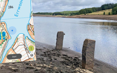
The water level in Errwood Reservoir has dropped significantly over recent weeks, revealing some interesting features from the past. Trying to identify where they once lay is a fascinating challenge.
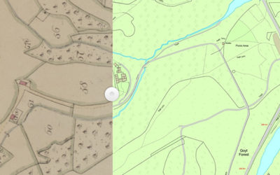
Comparing the recently discovered 1846 plans of the valley with OS maps from the 1890s reveal some fascinating changes, but also poses the question of when Grimshaw turned to Grimshawe.
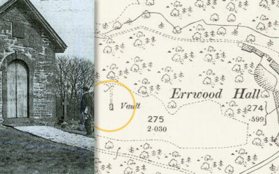
Another long-held theory of mine goes up in flames, thanks to the discovery of yet another old photo from the archives; the Grimshawe’s hill-top vault wasn’t where I’d always thought it was.
Two bridges – both close to Errwood Hall. One that I’d never seen before, and another which I wasn’t sure ever existed. All it needed to solve the mystery was a pair of wellington boots.
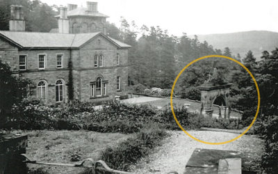
A recently discovered photo of Errwood Hall shows the grand arch which once formed the gateway to the Grimshawe family’s hill-top cemetery. The arch has long since gone, but the steps remain.

A virtual reality app designed to bring the ruins of Errwood Hall back to life is an exciting project. But you have to wonder what Samuel Grimshawe would have made of it.
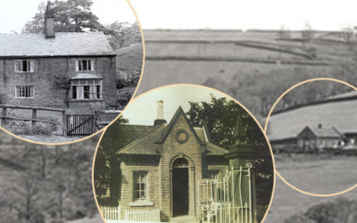
I’ve made a start at adding the final three houses to the the list of those demolished in the 1930s, following the purchase of the Errwood Estate by Stockport Corporation to build the twin reservoirs.
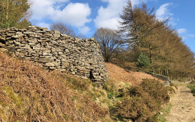
It’s easy to miss this lime kiln, near the southern tip of Errwood Reservoir. Coal from a nearby pit fired the kiln, reducing limestone to lime, which was used both as a fertiliser and to make mortar.
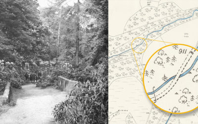
The recent news that the Forestry Commission will be removing what remains of the rhododendrons around the ruins of Errwood Hall is a great shame. But I’m not sure what we can do about it.
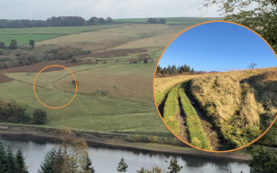
The felling of the fir trees above Fernilee has opened up some wonderful views across the valley. I was curious about some tracks running up from the path along the opposite side of the reservoir.
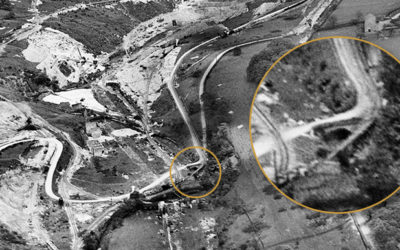
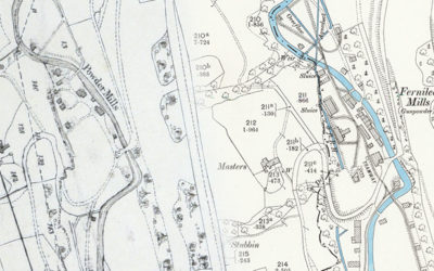
I managed to solve the question of whether the road from Goyt’s Bridge to Fernilee went through the gunpowder mill. But posed another with a photo of the mill entrance that just doesn’t seem right.
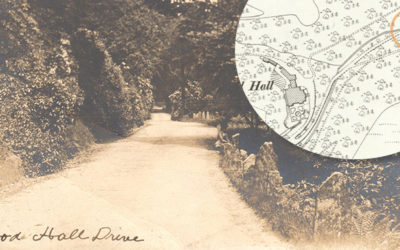
A rare discovery: a postcard from the early 1900s shows the drive from Goyt’s Bridge up to the Grimshawe family’s grand country house, Errwood Hall. It’s a very different scene today!
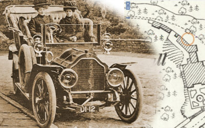
A photo of two young ladies dressed in mourning posing on an early motor car outside Errwood Hall has always intrigued me. A ‘Then & Now’ fade shows the scene today.
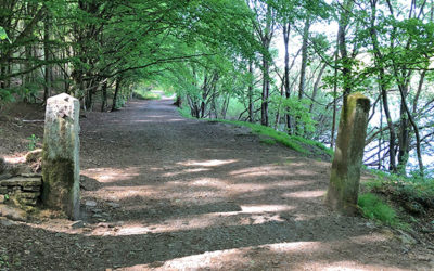
A couple of sturdy stone gateposts near the top of Old Goyt’s Lane once guarded access onto the track of the Bunsall Incline; the steep slope that today forms the main route into the valley.
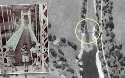
A 1948 article describing a walk through the Goyt Valley, from Whaley Bridge to Buxton, makes fascinating reading. It also reveals that I’d got the position of the suspension bridge completely wrong.
Continuing the hunt to trace the history of some of the stone gateposts that stand around the Goyt Valley – this time to the west of Fernilee Reservoir, on the main track and up to Intake Farm.
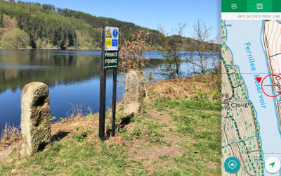
A pair of stone gateposts beside Fernilee Reservoir set me wondering about their history. Old maps reveal that they once stood at the entrance to a path that led down to the old gunpowder mill.
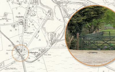
A recent book on the Cromford & High Peak Railway, which once ran through the Goyt Valley, includes a couple of photos of Ladmanlow Station, on the outskirts of Buxton. But does anything remain?
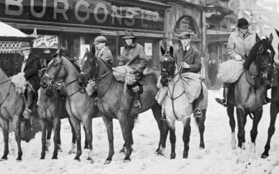
An intriguing photo dated 27 February 1933 and titled ‘Goyt Valley Relief Expedition’ shows a number of horsemen carrying provisions to the valley from Buxton following a severe snowstorm.