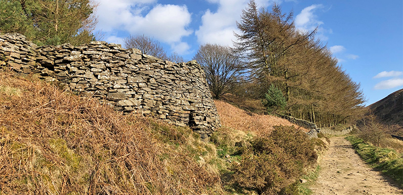
Above: This relic of a bygone age once produced lime to fertilise fields in the Goyt Valley.
I only noticed the remains of a lime kiln the other day, near the southern end of Errwood Reservoir, along the track from the bottom of Old Goyts Lane, just a short distance past the bird-feeder tree. I checked John Barnatt’s extensive archaeological 1994 survey of the valley and it includes this description:
This is a fine example of a lime kiln. It is drystone-wall retained on the downslope side, the wall still standing to nearly its original height. At the centre of this side is the drawing hole, with a short passage leading to the internal base of the kiln. This passage is bottle-shaped in section, with a top hole separated from the passage below by a horizontal slab. This was presumably a draft hole.

The kiln was loaded from the top and there is a short approach track from the north west which joined lane 107*. It was emptied from the lane below the kiln, which again joins lane 107. The location against this route way suggests that lime was brought down the lane from the Buxton/Burbage area, the nearest source of limestone.
Coal to fire the kiln may have come from within the valley, perhaps from the bell pits at feature 174*. The lime from the kilns was presumably used on the fields in the immediate vicinity and on the fields below in the valley around Goytsbridge.
Above: Drag the slider to see both old and new views showing the position of the old lime kiln and the associated coal pits.
*There’s a pdf of John Barnatt’s archeological survey at the bottom of this page. 107 is Old Goyt’s Lane, and 174 the coal pits which John thinks fuelled the kilns.
