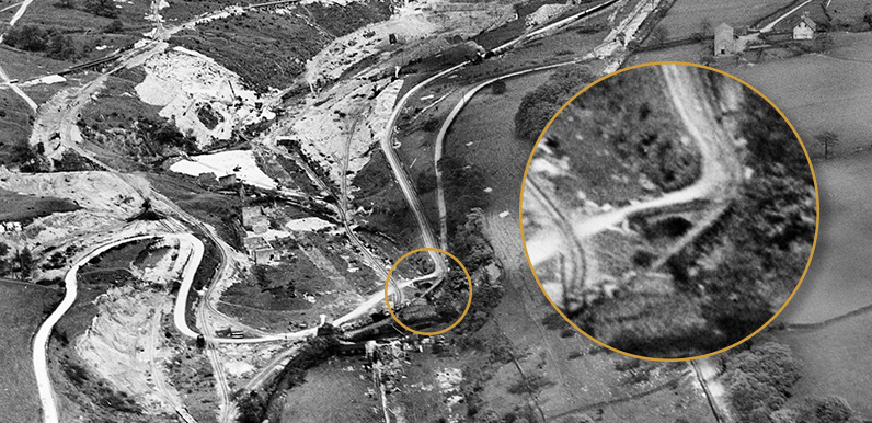
Above: Taken in 1934, this aerial photo shows the lane coming north from Goyt’s Bridge at far left, winding down to a small bridge spanning the Goyt (circled), before heading up the Valentine to Fernilee.
Someone writing before the construction of the twin reservoirs described the route following the Goyt from the Cat & Fiddle through to Fernilee as “one of the loveliest drives in Derbyshire”.
I was always curious about the gunpowder mill, at the northern end of the drive. I couldn’t understand why they allowed people to pass through such a dangerous site. Especially as it had been the scene of so many fatal explosions over the years.
So I wondered whether the drive bypassed the mill, by going further up the valley into Whaley Bridge. But things became a little clearer as I worked on the video on the history of Fernilee Reservoir.
I tracked down a series of aerial photos taken of the construction site in 1934. And compared them with a detailed map of the area dating back to the early 1900s. This revealed a small, stone bridge that I hadn’t seen in any other photos of the valley (top of page).
Above: This fade shows the position of the small bridge (circled). Click the Now button – or drag the slider – to see where it lies today, beneath the waters at the northern end of Fernilee Reservoir.
The map and aerial photo clearly show that the road didn’t go through the gunpowder factory. It passed to one side, heading past the entrance and across the stone bridge, up the Valentine to Fernilee and the Whaley Bridge to Buxton, Long Hill Road.
It joined the road beside a small, attractive house known as the Lodge, which has long since vanished from the landscape. Click here for more on my hunt for this building.

Another mystery…
I’ve always understood that this photo shows the entrance to the gunpowder mill. So I was expecting to see signs of the stone bridge. But there’s nothing obvious.
Also, the road seems to wind the wrong way into the entrance – from the left. And according to the map, it should come in from the right. I did wonder whether it’s a view coming the other way – from Goyt’s Bridge and past Masters Farm. But this doesn’t seem to match up with the map either.
So I’ve managed to solve one problem, and pose another! Hey ho…
Page updates…
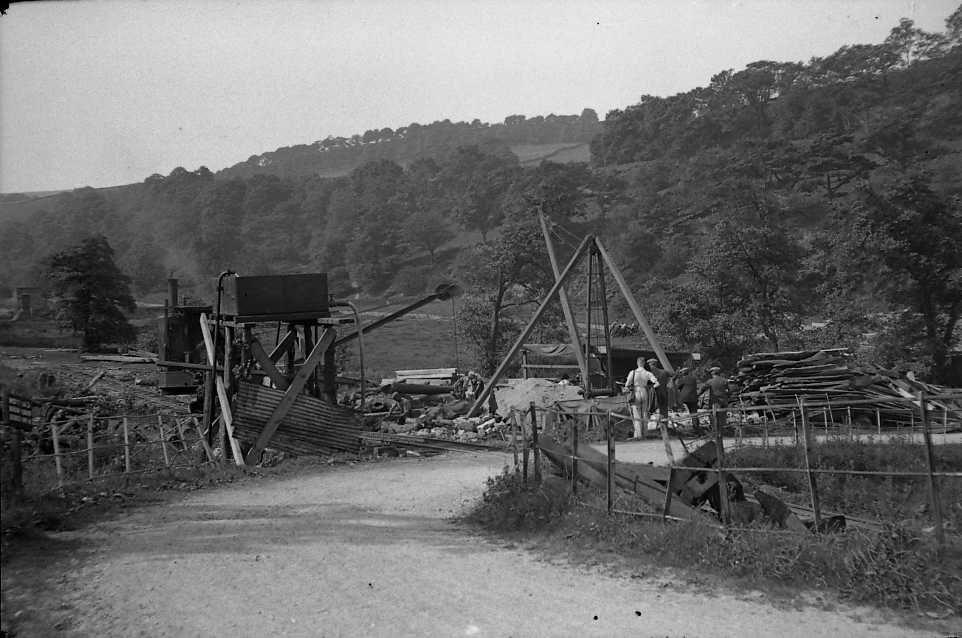
Many thanks to Chris for sending a link to this photo she found on the Whaley Bridge Local History website, taken during the construction of Fernilee Reservoir in the mid ’30s (click to enlarge). The railings are identical to those in the photo of the mill entrance.
It’s just possible to make out some of the gunpowder mill ruins at the extreme left. So the Goyt must flow from left to right just below the large tree on the left. Which means the bridge must be further around the lane to the right. With the mill entrance just beyond.
Click here to view a recently-discovered photo of the Powder Mill Bridge.

It was not unusual working with negatives in the darkroom to make the mistake of printing images the wrong way round. Does it work if you “flip” it?