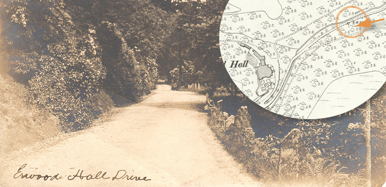
Above: I’m still not 100% sure, but I think the orange circle on the old map shows the view. The solid parallel lines show Shooters’ Clough stream.
My thanks to Angela for allowing me to scan a rare postcard from her collection that I’d never seen before. Captioned ‘Erwood Hall Drive’, it’s a view along the lane between the small hamlet of Goyt’s Bridge and Errwood Hall, the country house of the Grimshawe family who once owned the Errwood estate.
The remains of Goyt’s Bridge now lie under the southern end of Errwood Reservoir. The drive ran under the modern metal bridge, just before the small car park, and it’s still possible to see its faint remains when the water level drops.
At first I wasn’t sure whether it’s a view towards the hall, or down from it towards the gates that once stood beside Errwood Cottage. There’s a faint line at the far end that I thought could be the gates. But I think it’s probably just a scratch on the image.
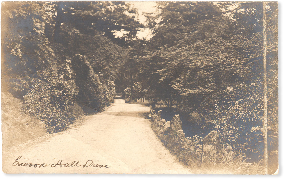
Above: the drive is bordered by rhododendrons, with Shooters’ Clough running alongside (click to enlarge).
Today, the drive joins the path to the ruins of the hall near the bottom of the slope, emerging through dense undergrowth on the right. (The two paths are clearly shown on the map at the top of the page.) I think this would have been about half way along this view.
Above: This fade is a similar view along the drive, but from the opposite direction – from the hall towards Goyt’s Bridge. The track running up the slope on the right is today’s path to Errwood Hall carpark. It’s easier to see the old drive in winter when the undergrowth isn’t so dense. (Click here for more on this image).

And some of those stones still stand today! See my recent post on the Goyt Valley Appreciation Page 🙂
Chris; yes I’ve seen the marker stones as well – just a few of them left now in 2025. They would have looked decorative on the old driveway. Theres also a small stone archway/bridge has gone hidden away on the river bed driveway itself probably the orignal one from the 1800s. I found a few bits of old pottery in the river – bet it’s from Errwood Hall.
Can you visit Errwood Hall at any time and how much does it cost to visit?
Anyone knows why the hall was demolished? Really sad it was wonderful.