8. Errwood to Shining Tor
A detailed, step-by-step description and map of this walk are available to download for just £1.85. A walking app GPX file is also available at £1.50. Save on both for just £2.95. All proceeds help cover the hosting costs of this website.
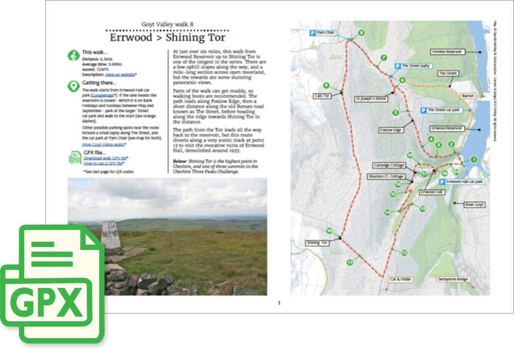
Walk description…
Length: 6.3mls
Av. time: 3hrs
Ascent: 1247ft
Start: Errwood Hall car park
At just over six miles, this walk from Errwood Reservoir up to Shining Tor is one of the longest in the series. There are a few uphill slopes along the way, and a mile-long section across open moorland, but the rewards are some stunning panoramic views. Parts of the walk can get muddy, so walking boots are recommended.
The path leads along Foxlow Edge, then a short distance along the old Roman road known as The Street, before heading along the ridge line towards Shining Tor.
The path from the Tor leads all the way back to the reservoir, but I enjoy taking a detour along the small footpath down Shooter’s Clough, and on to the ruins of Errwood Hall.
‘Relive’ video…
Click to play. Click expand button to view in full screen.