27. C&HP Railway Short Circuit
A detailed, step-by-step description and map of this walk are available to download for just £1.85. A walking app GPX file is also available at £1.50. Save on both for just £2.95. All proceeds help cover the hosting costs of this website.
Walk description…
Length: 2.3mls
Av. time: 1hr
Ascent: 246ft
Start: Goyt’s Lane car park
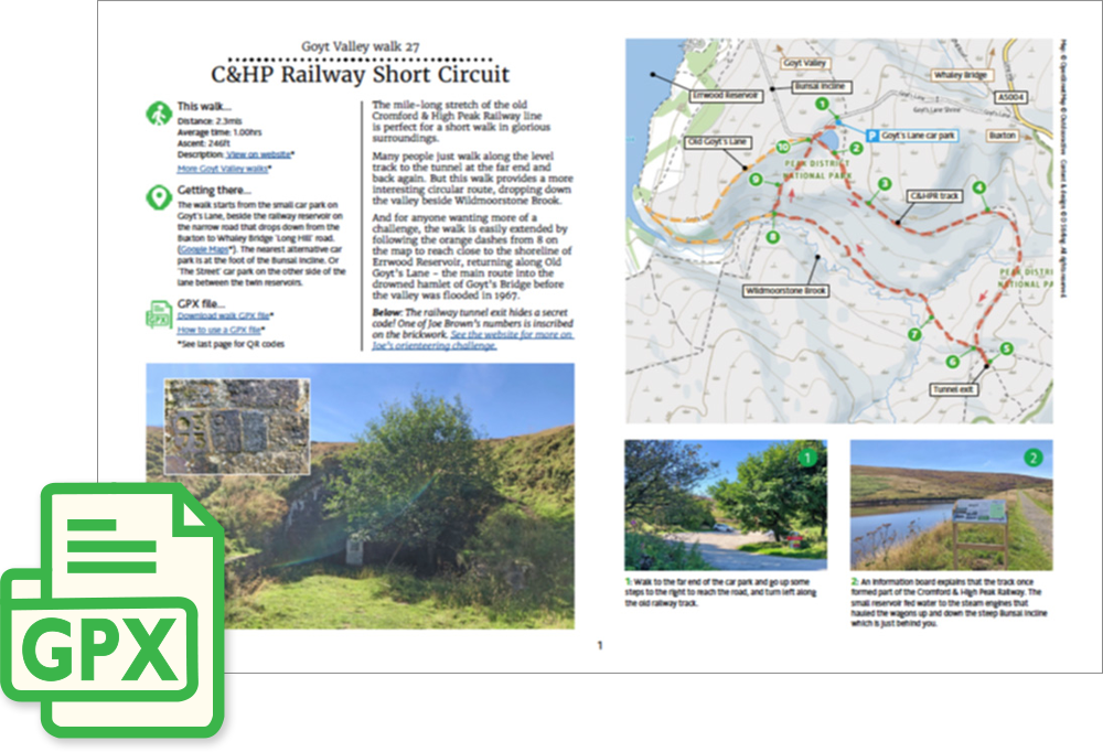
The mile-long stretch of the old Cromford & High Peak Railway line is perfect for a short walk in glorious surroundings.
Many people just walk along the level track to the tunnel at the far end and back again. But this walk provides a more interesting circular route, dropping down the valley beside Wildmoorstone Brook.
And for anyone wanting more of a challenge, the walk is easily extended by following the orange dashes from 8 on the map to reach close to the shoreline of Errwood Reservoir, returning along Old Goyt’s Lane – the main route into the drowned hamlet of Goyt’s Bridge before the valley was flooded in 1967.
‘Relive’ video…
Click to play. Click expand button to view in full screen.