23. Corbar to Errwood Reservoir
A detailed, step-by-step description and map of this walk are available to download for just £1.85. A walking app GPX file is also available at £1.50. Save on both for just £2.95. All proceeds help cover the hosting costs of this website.
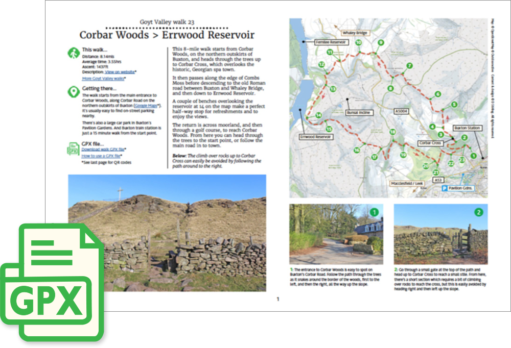
Walk description…
Length: 8.4mls
Av. time: 3.55hrs
Ascent: 1437ft
Start: Corbar Road Buxton
This 8-mile walk starts from Corbar Woods, on the northern outskirts of Buxton, and heads through the trees up to Corbar Cross, which overlooks the historic, Georgian spa town.
It then passes along the edge of Combs Moss before descending to the old Roman road between Buxton and Whaley Bridge, and then down to Errwood Reservoir.
A couple of benches overlooking the reservoir at 14 on the map make a perfect half-way stop for refreshments and to enjoy the views.
The return is across moorland, and then through a golf course, to reach Corbar Woods. From here you can head through the trees to the start point, or follow the main road in to town.
‘Relive’ video…
Click to play. Click expand button to view in full screen.