5. Whaley Bridge to Taxal
A detailed, step-by-step description and map of this walk are available to download for just £1.85. A walking app GPX file is also available at £1.50. Save on both for just £2.95. All proceeds help cover the hosting costs of this website.
Walk description…
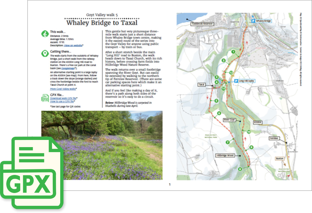
Length: 2.9mls
Av. time: 1.15hrs
Ascent: 171ft
Start: Whaley Bridge Wharf car park
This gentle but very scenic 3.5 mile walk starts just a short stroll from Whaley Bridge town centre. Making it the easiest route of the series into the Goyt Valley for anyone using public transport – by train or bus.
I’ve marked the start point as the free car park at Canal Wharf, which is opposite the train station, but it’s normally fairly easy to find parking closer to the start point opposite Mevril Road.
The walk passes Taxal Church, with its rich history, before heading across farm fields to a small bridge over the Goyt. And then returns alongside the very picturesque river bank path.
The walk can easily be extended by circling Fernilee Reservoir, and going even further to Errwood Reservoir.
‘Relive’ video…
Click to play. Click expand button to view in full screen.