19. Axe Edge Moor
A detailed, step-by-step description and map of this walk are available to download for just £1.85. A walking app GPX file is also available at £1.50. Save on both for just £2.95. All proceeds help cover the hosting costs of this website.
Walk description…
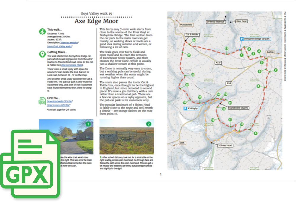
Length: 7.1mls
Av. time: 3hrs
Ascent: 823ft
Start: Derbyshire Bridge car park
This fairly easy 7-mile walk starts from close to the source of the River Goyt at Derbyshire Bridge. The first section from the car park to the main road can get muddy, so walking shoes or boots are a good idea during autumn and winter, or following a lot of rain.
The walk goes over fairly bleak and open moorland to reach the remains of Danebower Stone Quarry, and then crosses the River Dane, which is usually just a shallow stream at this point.
The Dane is normally very easy to cross, but a walking pole can be useful during wet weather when the water might be running higher than usual.
The route also passes the iconic Cat & Fiddle Inn, once thought to be the highest in England, but since demoted to second place! It’s now a gin distillery with a cafe rather than a traditional pub.
There are a few car spaces on a layby opposite, but the pub car park is for customers only. The popular landmark of Three Shires Head is fairly close to the route and well worth a detour – see orange dashes on the map from point 10.
‘Relive’ video…
Click to play. Click expand button to view in full screen.