26. Windgather Rocks to Shining Tor
A detailed, step-by-step description and map of this walk are available to download for just £1.85. A walking app GPX file is also available at £1.50. Save on both for just £2.95. All proceeds help cover the hosting costs of this website.
Walk description…
Length: 10.7mls
Av. time: 4.55hrs
Ascent: 1411ft
Start: The Street car park
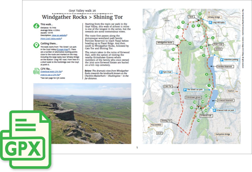
Starting from the main car park in the Goyt Valley, this walk of almost 11 miles is one of the longest in the series, but the rewards are some tremendous views.
The route first passes along the picturesque woodland path beside Fernilee Reservoir to reach Taxal before heading up to Taxal Ridge. And then south to Windgather Rocks, followed by Cats Tor and Shining Tor.
The return takes in the ruins of Errwood Hall, with the option of visiting the nearby Grimshawe Graves where members of the family who once owned the 2010 acre Errwood Estate are buried on a hill-top cemetery.
‘Relive’ video…
Click to play. Click expand button to view in full screen.