15. Errwood to Goytsclough
A detailed, step-by-step description and map of this walk are available to download for just £1.85. A walking app GPX file is also available at £1.50. Save on both for just £2.95. All proceeds help cover the hosting costs of this website.
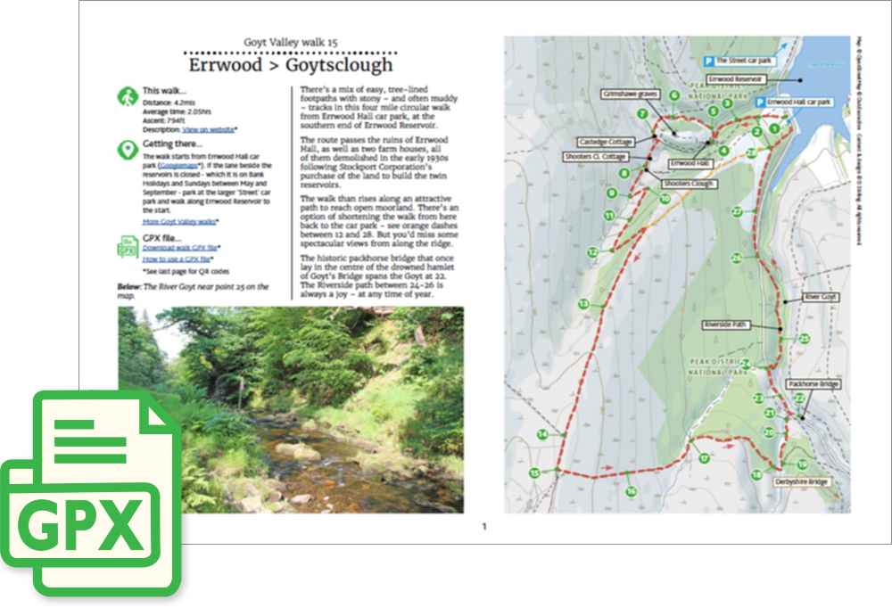
Walk description…
Length: 4.2mls
Av. time: 2.05hrs
Ascent: 794ft
Start: Errwood Hall car park
There’s a mix of easy walking along tree-lined footpaths with stony – and often muddy – tracks in this five mile circular walk.
Starting from Errwood car park, it passes the ruins of Errwood Hall before rising across open moorland and then descending to Goytsclough and the one-way road between the reservoir and Derbyshire Bridge.
The historic packhorse bridge nestles in the valley beside Goytsclough. The Riverside path back to the car park is always a joy – at any time of year.
Update: Forestry England recently removed a small walkway over the stream between points 5 and 6 (click for details). This has made it slightly more challenging to get from one side to the other, especially when it’s muddy or the water is running fast. But I’ve never found it difficult to cross over, stepping from one stone to another.
‘Relive’ video…
Click to play. Click expand button to view in full screen.