Detailed directions for all the walks featured on this website, each with step-by-step descriptions and photos, as well as a map, are now available to download as printable pdf files.
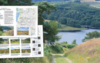
Detailed directions for all the walks featured on this website, each with step-by-step descriptions and photos, as well as a map, are now available to download as printable pdf files.
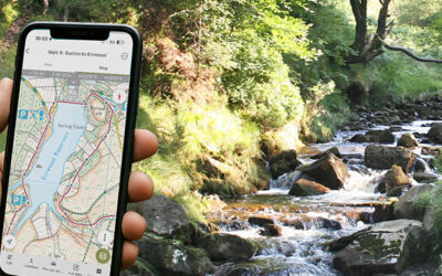
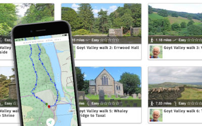
GPX files for all 30 walks in and around the Goyt Valley featured here are now available, with a step-by-step guide on how to install them on a walking app to find your way around a route.
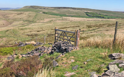
Joe Brown’s Numbers is a 20-mile orienteering challenge around the Goyt Valley created by the famous climber in the 1960s. I’ve divided it into two more manageable walks with clues.
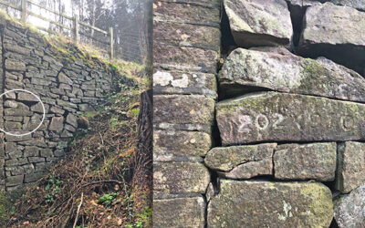
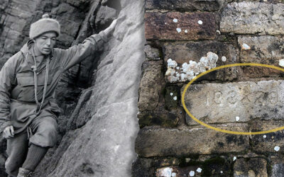
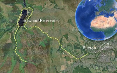
A recently discovered set of numbers are similar to those on Joe Brown’s orienteering challenge. But these point to Errwood Bridge, which now lies under Errwood Reservoir.
The mystery of the vanished footbridge along the path around the ruins of Errwood Hall deepens. I’m just hoping Forestry England will replace it. But their silence makes me fear for the worst.
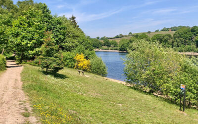
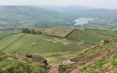
Walk 28 circuits both Fernilee and Errwood Reservoirs. It’s a perfect way to enjoy the many glories of the Goyt Valley, including the historic packhorse bridge and the enigmatic ruins of Errwood Hall.
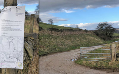
Things finally seem to happening with the application to preserve public rights of way along a stretch of the old Cromford & High Peak Railway which once led into the Goyt Valley. But we need your support.
Walk 27 – an easy two-mile circuit from the small car park half way down Goyt’s Lane along the old C&HPR track, returning along the narrow path to Errwood Reservoir. And very easy to extend.
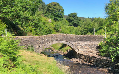
Great news; the historic packhorse bridge which once lay in the heart of the now drowned hamlet of Goyt’s Bridge has finally been repaired and the barriers removed.
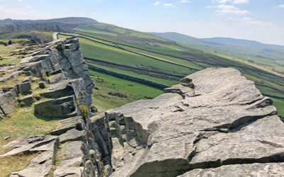
Starting from the main car park, this 11-mile walk includes wonderful views from both Windgather Rocks and Shining Tor, before dropping down to visit the ruins of Errwood Hall.
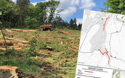
The Forestry Commission has begun the second phase of tree felling in the valley to tackle the outbreak of phytofra, this time to the west and south of Errwood Reservoir.
My favourite walking app, ViewRanger, is being taken over by a new one – OutdoorActive. I’ve transferred all the Goyt Valley walks over, so I’m hoping it’s as reliable as the old app.
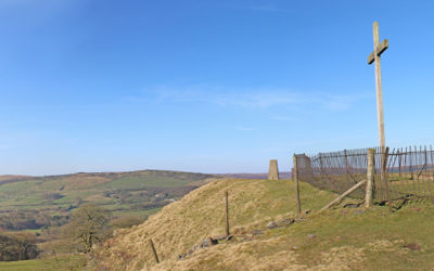
Starting from Buxton’s famous Crescent, this walk passes through both the Pavilion Gardens and Serpentine Walks before rising up to Burbage Edge, along the southeast border of the Goyt Valley.
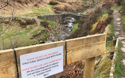
It’s sad to see that the picturesque packhorse bridge at Goytsclough has been closed due to some of the stonework collapsing into the Goyt. I’m hoping United Utilities don’t take long to repair it.
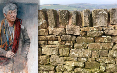
Joe Brown died last year, acknowledged as one of Britain’s finest mountaineers. In the early ’60s Joe created an orienteering course in and around the Goyt Valley, known as ‘Joe Brown’s Numbers’.
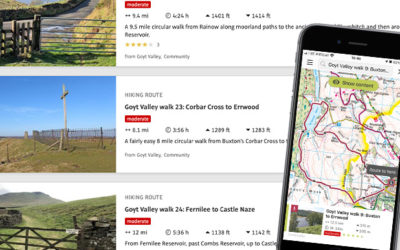
This 12-mile walk starts from Fernilee Reservoir, passing Taxal Church and Combs Reservoir before climbing to the ancient Iron Age fort of Castle Naze, and returning along Combs Edge.
I’ve just added walk 23 to the series. It’s an easy but rewarding eight miles from Corbar Woods down to the Goyt Valley, passing Errwood Reservoir and returning though Cavendish golf course.
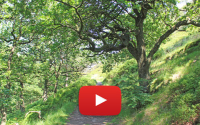
The previous video was photographed to capture the colours of autumn. This one was recorded during a gloriously warm and bright summer’s day. There’s also two versions to choose from.

My attempt at a bit of slow-TV features a leisurely stroll from Buxton’s famous Opera House to the ancient packhorse bridge over the Goyt, backed by some of my favourite chilled jazz tracks.
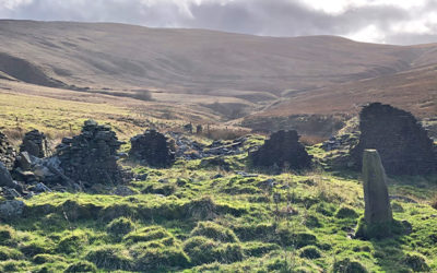
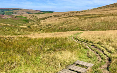
Starting from Rainow, walk 22 in the series is just under 10 miles, and crosses some fairly bleak moorland to reach the evocative ruins of Thursbitch, before returning alongside Lamaload Reservoir.
All the walks on this website are now available on the ViewRanger app. Which should make following them a lot easier for anyone with a smartphone. Well that’s the theory!
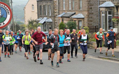
South Manchester’s Long Distance Walking Association recently held a 25-mile challenge through the Goyt Valley. My legs wouldn’t be up to it. But here’s the route for those built of sterner stuff.
With winter fast approaching, I thought I’d add another walk to the series to capture the glorious colours of autumn in the valley. This 9-mile walk from Buxton includes some famous landmarks.
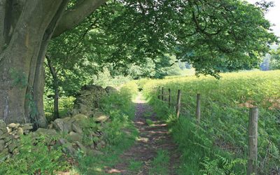
I’ve been tidying up the walks featured on the website. And taking advantage of the recent, record-breaking sunshine to retake some of the photos previously shot in the depths of winter.
An easy walk from Whaley Bridge to Taxal provides easy access into the northern end of the Goyt Valley for anyone using public transport. I find this part of the valley wonderfully picturesque.
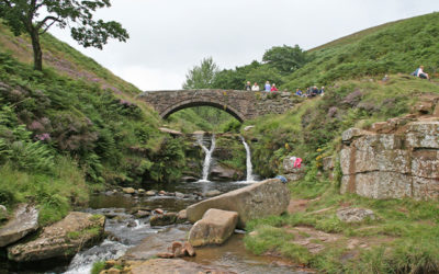
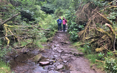
With the weather turning wet and windy, I thought it a good time to hunker down and catch up with a couple of walks I’ve photographed, but not posted. Starting with Three Shires Head.
Experience one of the most popular walks on the site, the 8-mile circular walk from Buxton to Errwood Reservoir, courtesy of Google Earth and some magical 3D satellite image wizardry.
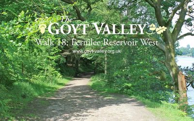
Hot on the heels of the video for walk 17 comes the one for walk 18; a very easy 2.5 mile circular walk around the west of Fernilee Reservoir. There are some wonderful views from the upper section.
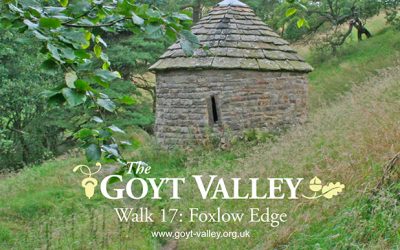
I’ve just added the video for walk 17: a short, 1.5 mile circular stroll along Foxlow Edge, returning along the narrow footpath which runs between the ruins of Errwood Hall and St. Joseph’s Shrine.
Recorded at the start of a mini heat-wave in June 2017, this 2.5 mile circular stroll is the first in the series to start from the small car park at the northern tip of Fernilee Reservoir.