An obvious drawback with trains is that they can’t get up and down slopes. An experiment carried out in the Goyt Valley over 150 years ago tried to solve this problem.
An obvious drawback with trains is that they can’t get up and down slopes. An experiment carried out in the Goyt Valley over 150 years ago tried to solve this problem.
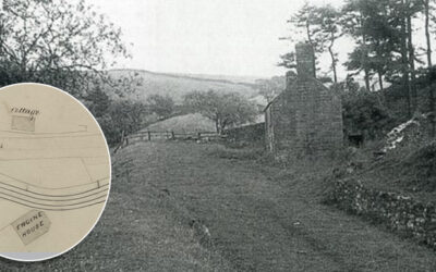
A grainy photo of a building half-way down the Bunsall Incline has always intrigued me. A recently discovered map from around 1855 shows it marked as a cottage, lying opposite a long-lost engine house.
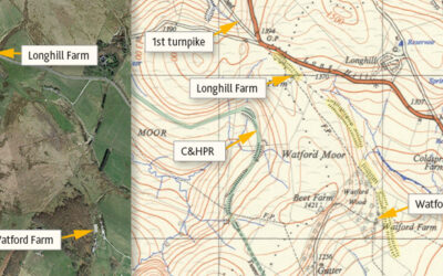
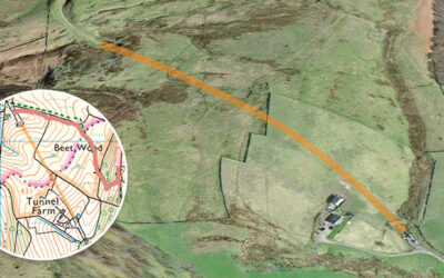
Many theories have been proposed for the mysterious, mile-long earthwork between Watford and Longhill Farms. Was it for a large gun, a railway test track, or perhaps an abandoned turnpike extension?
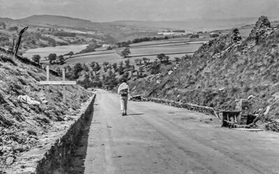
Some photos taken in 1967, shortly before the completion of Errwood Reservoir, including views along the Bunsall Incline as well as the suspension bridge which once spanned Fernilee Reservoir.
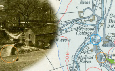
A 1918 photo taken from Goyt’s Lane towards Goytshead Farm comes frustratingly close to revealing a second set of stepping stones close to the packhorse bridge in Goyt’s Bridge.
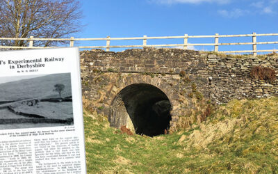
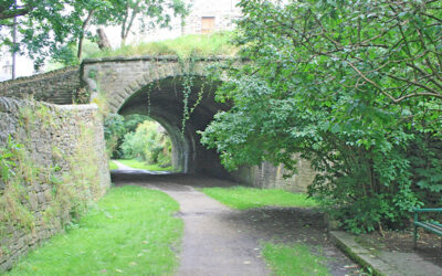
A couple of photos recently discovered on ebay show the southern end of the tunnel on the disused Cromford & High Peak Railway line being blocked off, probably sometime in the early ’60s.
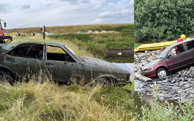
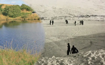
The discovery of two cars in the pond beside Goyt’s Lane, and rumours of bodies being found in the boots, attracted media attention. There were also four safes plus a cache of bullets.
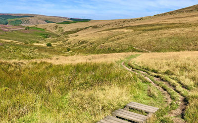
Walk 27 – an easy two-mile circuit from the small car park half way down Goyt’s Lane along the old C&HPR track, returning along the narrow path to Errwood Reservoir. And very easy to extend.
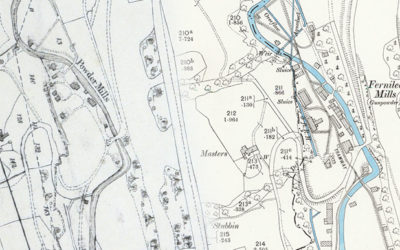
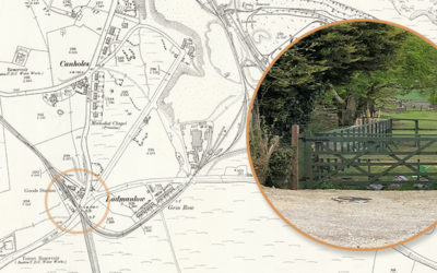
Comparing the recently discovered 1846 plans of the valley with OS maps from the 1890s reveal some fascinating changes, but also poses the question of when Grimshaw turned to Grimshawe.
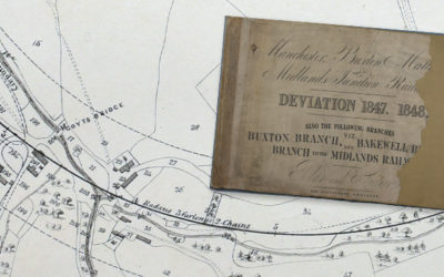
In this second part of Alan Robert’s article on railways through the Goyt Valley, he explains how the attempts to improve the Cromford & High Peak Railway by avoiding the steep inclines ended in failure.
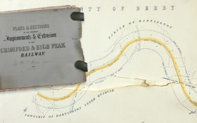
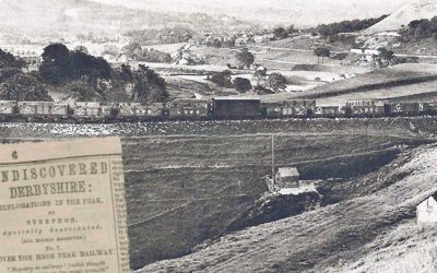
In the first of a two-part post, local historian Alan Roberts explains how a railway line proposed in 1846 between Manchester and Matlock would have cut right through the hamlet of Goyt’s Bridge.
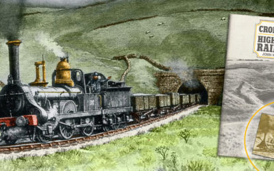
Thanks to the internet, social media and digital wizardry, we’ve transformed a poor-quality photocopy image of a train exiting Burbage Tunnel into something resembling the original painting.
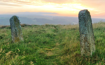
A couple of sturdy stone gateposts near the top of Old Goyt’s Lane once guarded access onto the track of the Bunsall Incline; the steep slope that today forms the main route into the valley.
An inquest into a fatal accident on the Cromford & High Peak Railway in 1877 ruled that passengers could no longer be carried on the line. A writer describes one of the last journeys, riding on the ‘Fly’.
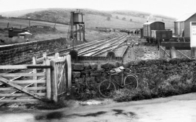
A recent book on the Cromford & High Peak Railway, which once ran through the Goyt Valley, includes a couple of photos of Ladmanlow Station, on the outskirts of Buxton. But does anything remain?
An early ’60s black and white photo of skaters on the frozen pond at the head of the Bunsall Incline brings back memories of an earlier scene, described in Strephon’s typically flowery style in an 1880 article.
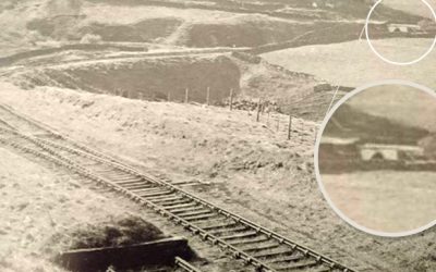
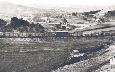
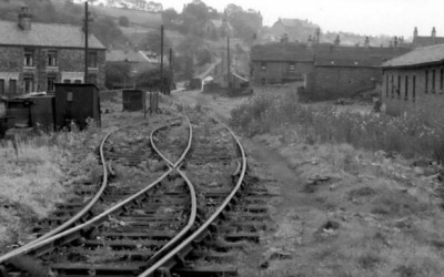
Trying to pinpoint the position of a section the C&HP Railway shown in an old photo posed a bit of a mystery. We think it might show a rare view of the track as it heads towards the valley.
A collision between two trains on the Cromford & High Peak Railway left one man dead and the other seriously injured. It also spelled the end of passengers being taken along the route.
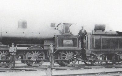
The Cromford & High Peak Railway ran through the Goyt Valley from 1831 to 1892. Mike has discovered a fascinating report from the Victorian writer, Strephon, of a trip along the entire route.
Opened in 1831, this 33 mile railway connected the Cromford Canal with the Peak Forest Canal in Whaley Bridge and was a triumph of Victorian ingenuity and determination.
This 9.4-mile walk follows – as far as possible – the route of the Cromford & High Peak Railway from the outskirts of Buxton to Whaley Bridge Canal Basin, returning by train.
Bill Reid writes: “Thanks for the great videos and information on the Goyt Valey and the Cromford & High Peak Railway. I have used your Walk no.12 to find my way along the old railway between Whaley Bridge and Burbage.”