An early 1900s postcard view titled ‘Goyt Valley’ had me scratching my head trying to work out where it was taken. Members of the Goyt Valley Facebook Group came to the rescue.
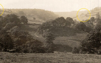
An early 1900s postcard view titled ‘Goyt Valley’ had me scratching my head trying to work out where it was taken. Members of the Goyt Valley Facebook Group came to the rescue.
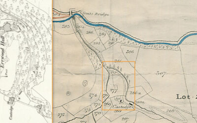
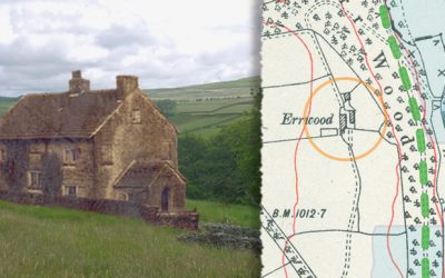
A detailed map published in 1832 for the sale of land in the Goyt Valley is the oldest I’ve seen. It must have been at this auction that Samuel Grimshaw purchased the land on which he’d build Errwood Hall.
An 1845 tithe map shows that Errwood Hall hadn’t yet been built, even though Samuel Grimshawe purchased the land some 13 years earlier. I thought work had started well before then.
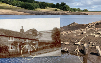
The water level in Errwood Reservoir has dropped significantly over recent weeks, revealing some interesting features from the past. Trying to identify where they once lay is a fascinating challenge.
I’d always understood that Errwood Hall was used as a Youth Hostel for a couple of years after Mary Grimshawe’s death in 1930. But according to recently discovered YHA records, that’s not correct.
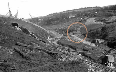
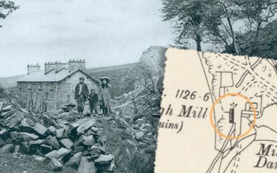
I’ve made a start at adding the final three houses to the the list of those demolished in the 1930s, following the purchase of the Errwood Estate by Stockport Corporation to build the twin reservoirs.
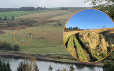
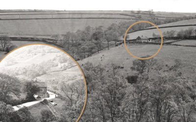
The felling of the fir trees above Fernilee has opened up some wonderful views across the valley. I was curious about some tracks running up from the path along the opposite side of the reservoir.
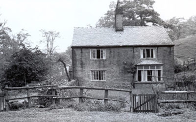
Thanks to Bill and Chris, I’ve managed to pinpoint the house known as The Hollows which featured in the collection of photos taken in the early 1930s, before work started on Fernilee Reservoir.
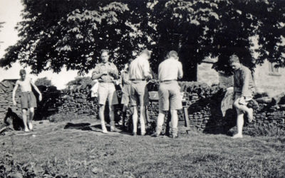
One of the collection of 1930s photos of the valley had even Bill Brocklehurst stumped. And he’s lived and farmed in the valley virtually all his life. But I think we’re getting closer to identifying it.
A mystery building alongside The Valentine has even Bill Brocklehurst stumped. And he’s lived and farmed in the Goyt Valley for most of his life. Perhaps it was Mrs Pickup’s shop…
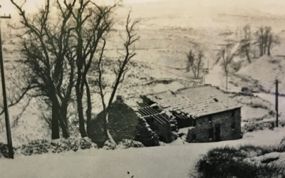
Another photo from the 1960s album shows Goyt’s Moss Farm in ruins. Which is odd as that this would mean it had been derelict for some 30 years. Perhaps the photo is earlier than I thought.
A writer in 1810 describes an ancient settlement close to Withinleach Farm. Today the farm is just a pile of stones beside the path to St. Joseph’s Shrine. It’s yet another Goyt Valley mystery.
A new ‘then & now’ fade of one of my favourite old photos of the valley helps pinpoint exactly where the cottages at Goytsclough once stood. And it’s not where I thought!
“One by one the farmers and their families have strapped their ancient bedsteads on to hay wagons, and tracked off up the lane leading out from Derbyshire’s deceased village of Fernilee…”
A new ‘then and now’ fade features one of my favourite photos of the Goyt Valley; Kathleen Nall collecting water at the natural spring outside her family home, Castedge Farm Cottage.
Rob has been in touch to say his family once lived at Goyt’s Moss, scraping a living mining coal from the small pits which once littered the landscape of this windswept part of the upper Goyt Valley.
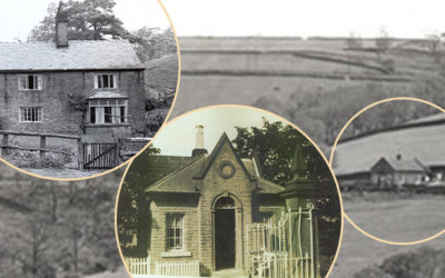
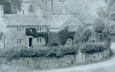
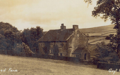
Samuel Grimshawe stayed at Errwood Farm to oversee the construction of Errwood Hall in the 1830s. This composite image shows the attractive farmhouse in today’s landscape.
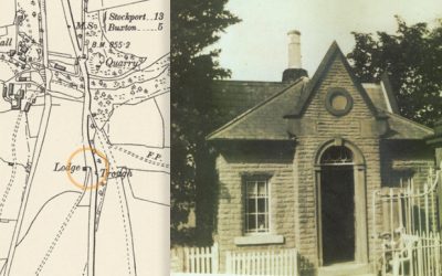
Gerald Hancock wrote ‘The Lodge’ on the back of this photo. But I’ve never been able to pinpoint where it was located. Could a lodge marked on an 1888 map of Fernilee provide the answer?
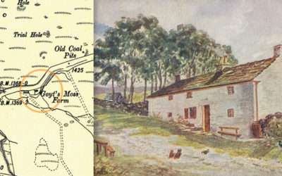
Goyt’s Moss Farm once lay beside the Macclesfield Old Road. It was completely rebuilt sometime after the 1930s and now serves as a Peak District National Park Rangers Information Centre.
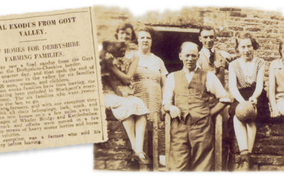
The last families to leave the Goyt Valley packed all their belongings on to lorries and horse-drawn carts in March 1936. I’m trying to trace their names, and the homes they once lived in.
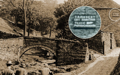
Trying to resolve the riddle of the Goyt’s Bridge tea room sign; we find Tommy Hibbert in the census returns – but it doesn’t help cast much light upon the mystery!
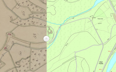
All that remains of Castedge Farmhouse today is a sad pile of stones beside a junction of footpaths showing the muddled outline of a once attractive and fairly substantial stone building.
Although marked on old OS maps as Errwood Cottage, it’s usually known as the ‘Gatehouse & Gardener’s Cottage’, and was situated beside the gates at the foot of the lane leading up to Errwood Hall.
Taken from a 1954 edition of the ‘Peakland’ magazine, Crichton Porteus recollects how the construction of the twin reservoirs led to the destruction of both Goyt’s Bridge and Errwood Hall.
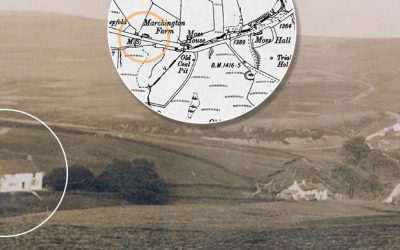
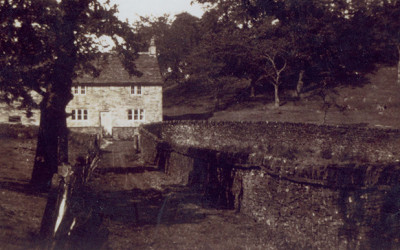
Sarah is searching for Errwood Farm where her grandparents once lived. But although she thinks it was the lowest-lying farm not to be submerged, she’s been unable to locate the ruins.