Jun 10, 2017 |
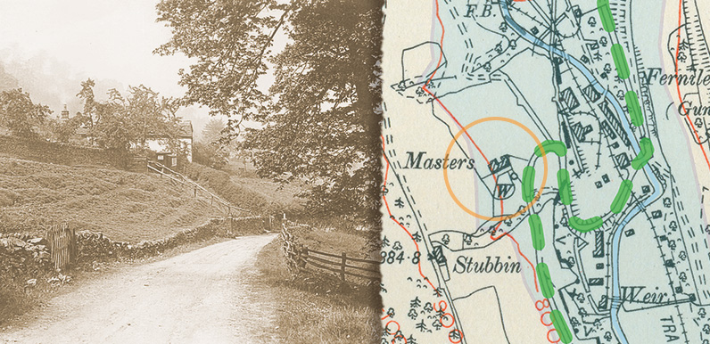
Above: The green dashes show the road from Goyt’s Bridge as it passes Masters Farm (above left and circled on the map) and winds down the valley towards the nearby Gunpowder Mill, and on to Fernilee and then Whaley Bridge. The blue area shows the...
Jun 9, 2017 |
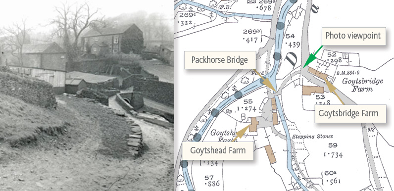
Above: This 1888 OS map shows that Goyt’s Bridge changed very little between then and the early ’30s when this photo was taken. The green arrow shows the direction of view. Goytshead Farm is opposite, and was a popular spot for afternoon teas. The...
Jun 3, 2017 |
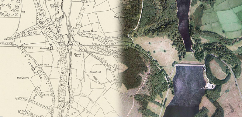
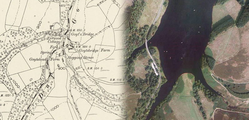
Above: There’s quite a change from the 1888 map on the left and a satellite image today. Fernilee Reservoir to the north was opened in 1937. Work on Errwood Reservoir was postponed because of the war. And was eventually declared open in 1968. The...
Jun 3, 2017 |
Click to enlarge the photo. Gerald Hancock, author of ‘Goyt Valley Romance’ – and sadly no longer with us – kindly allowed me to scan his collection of Goyt Valley photos when I first started this website back in 2010. The...
Jun 1, 2017 |
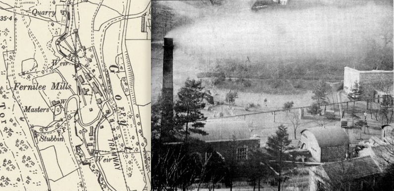
Above: The Gunpowder Mill once employed over 100 men, and was by far the largest employer in the valley. This is the only photograph I’ve managed to find of the factory in operation. It closed in 1920. Click here for more information and photos of the mill....
May 31, 2017 |
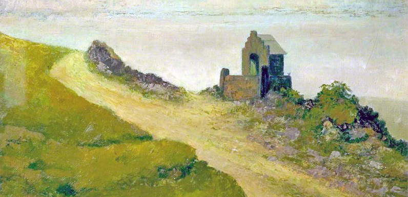
Above: Click to view a larger image of the painting. If anyone can help identify the artist, please get in touch. Or leave a comment below. Above: The artist’s signature (click to enlarge). Can anyone make it out? Above: The shrine today, taken by Gail under...
May 31, 2017 |
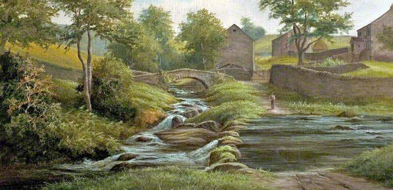
Above: Click to view a larger image of the painting. Mike has just found this wonderful oil painting of Goyt’s Bridge in Buxton Museum’s art collection. The artist is shown as GM Brown with a date of late 19th century, but there are no other details....
May 29, 2017 |
Above: I find it fascinating to compare the Victorian maps with today’s satellite images. On the left is the hamlet of Goyt’s Bridge from the 1888 OS map. And on the right is a satellite photo showing the scene today – the southern tip...
May 17, 2017 |
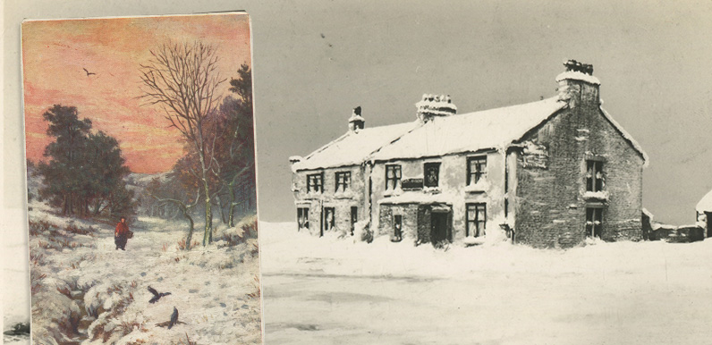
Above: These winter views are from Corrie’s collection of old postcards. An old lady in a red shawl with her basket of shopping walks beside the Goyt. And the Cat & Fiddle Inn in deep snow – which was probably the ‘lone hostel on the...
May 1, 2017 |
Above: Click the photo to view the full image. It was taken looking down the incline. Fernilee Reservoir, which was completed in 1937, lies in the valley behind. Above: Another photo of the Bunsal Incline before it was tarmacked in 1967 (click to enlarge)....
