Feb 12, 2022 |
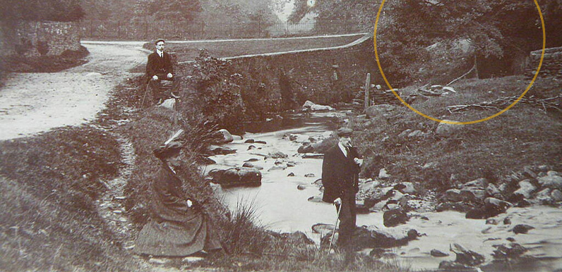
Above: Chris’s eagle eyes had spotted the arch of a bridge at top right. This postcard view dating back to the early 1900s popped up on ebay the others day, captioned ‘Goyt Valley’. But I struggled to make out where it was taken. I thought it might...
Dec 30, 2021 |
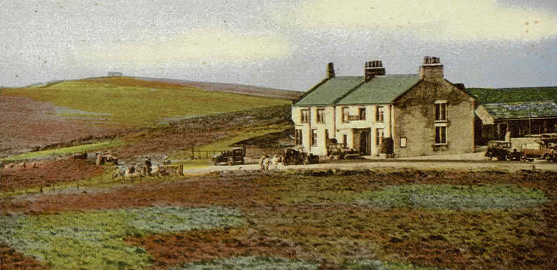
Dr Michala Hulme is an award-winning historian and professional genealogist based at the University of Birmingham. Many thanks to historian and genealogist Michala Hulme for allowing me to reproduce her recent post on the history of the famous Cat & Fiddle Inn,...
Dec 19, 2021 |
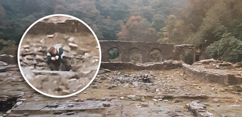
Above: Taken in 1988, this photo shows Trevor’s son peering into a hole in the central courtyard at Errwood Hall. I wonder whether it might be the entrance to the cellars. This is the same scene today (click to enlarge). I’ve often heard people talk about the...
Dec 13, 2021 |
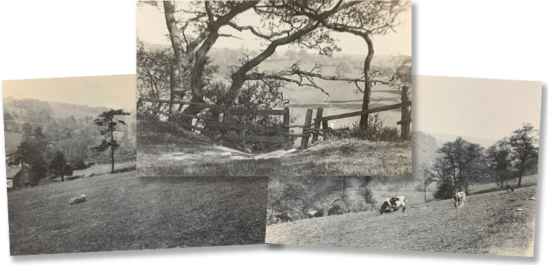
Above: These three photos recently popped up on ebay, captioned ‘Goyt Valley 1950s’. Ebay is a great source for old postcards of the Goyt Valley. They pop up fairly regularly. But I’ve seen most of them before. These three were different as...
Nov 30, 2021 |
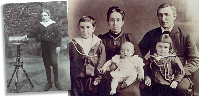
Above: Janette thinks Joseph may be the baby sat on his mother’s lap, alongside his father Ignatius, and his elder brother and sister. The recently discovered photo on the left shows him in his Sunday best. I’d guess the book is the bible. You can see the...
Nov 26, 2021 |
Above: The app will bring the ruins of Errwood Hall to life. You have to wonder what Samuel Grimshawe would have made of the recently announced plan to create an augmented reality app for his country house, Errwood Hall! Built in the early 1840s, the hall was...
Nov 22, 2021 |
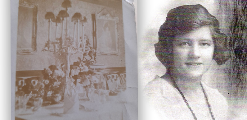
Above: After attending the Grimshawe’s one-room school, Mary Heather went on to work as a servant at Errwood Hall. She told her daughter that the photo was taken inside the hall – perhaps before one of the Grimshawe’s many house parties. It may seem...
Oct 27, 2021 |
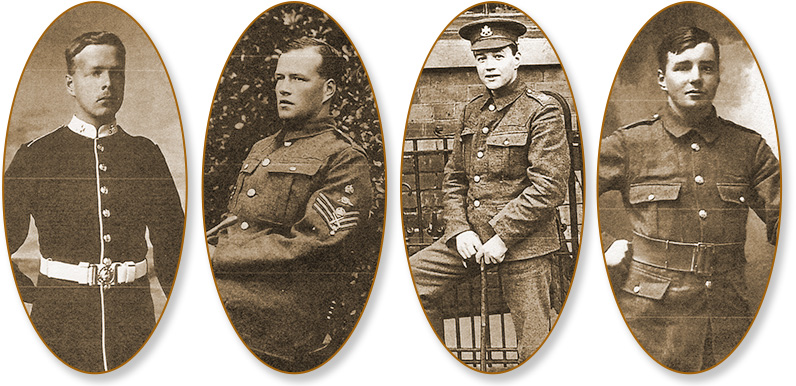
Above: The four Heather brothers in army uniform (from left): Fred (b.1891), Bert (b.1892), Joseph Harold (b.1893/4) and Arthur Percy (b.1895). Above: The five Heather sisters (clockwise from top left): Florence (Marie’s grandmother), Lily, Winifred, Genevieve...
Sep 4, 2021 |
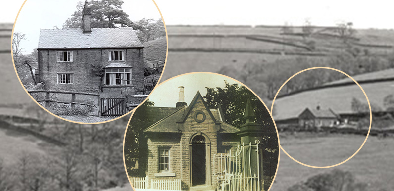
Above: From left to right; The Hollows, Upper Lodge and Lower Lodge. I’ve finally managed to complete a job I’ve been meaning to do for a while – to add the details of three houses at the northern end of the valley to the ‘Houses &...
Aug 28, 2021 |
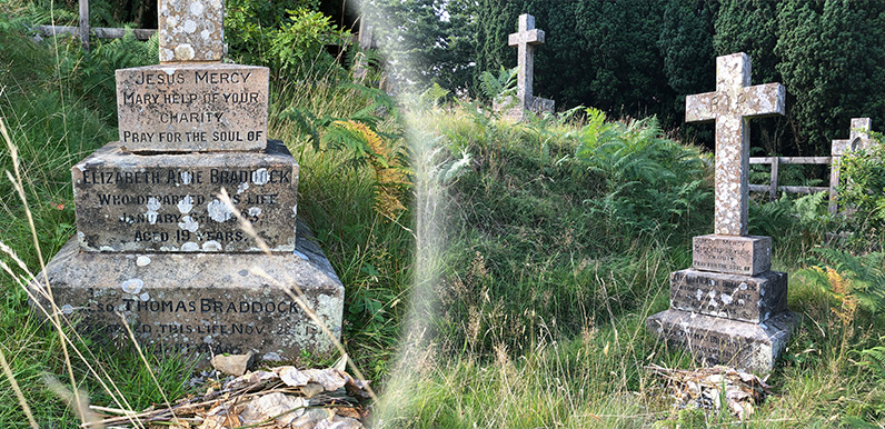
Above: 19-year-old Elizabeth Braddock died some eight years before her father and must have held a special place in the heart of the Grimshawe sisters to be buried on the family’s hill-top cemetery. One of the graves at the Grimshawe’s family cemetery,...
