Oct 9, 2015
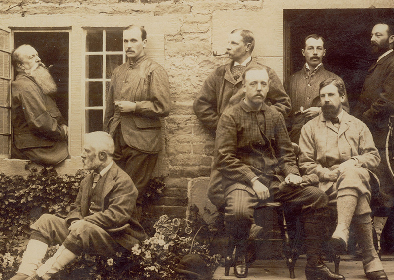
A series of four photographs taken at what must have been an annual sooting party for friends of the Grimshawes of Errwood Hall. In the sequence shown, they’re dated 1881, 1882, 1883 and 1887. I’ve captioned them with information taken from the original photos. The...
Oct 9, 2015
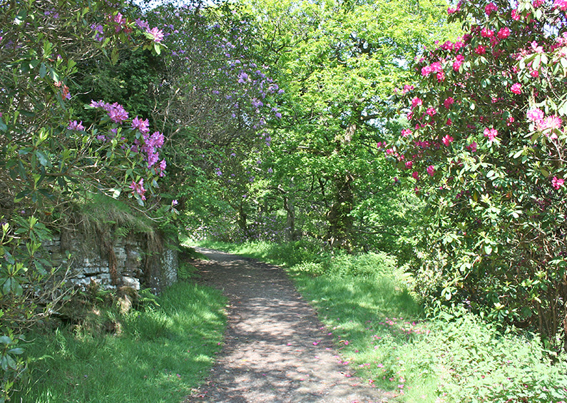
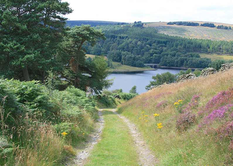
Goyt Valley walk 7: The rhododendrons Walk distance: 2 miles | Date recorded: June 2011Start point: Errwood Hall car park | Google MapGPX file: Just £1.50 | Download file I recorded this walk to capture the rhododendrons that bloom so magnificently in June*. But...
Oct 9, 2015
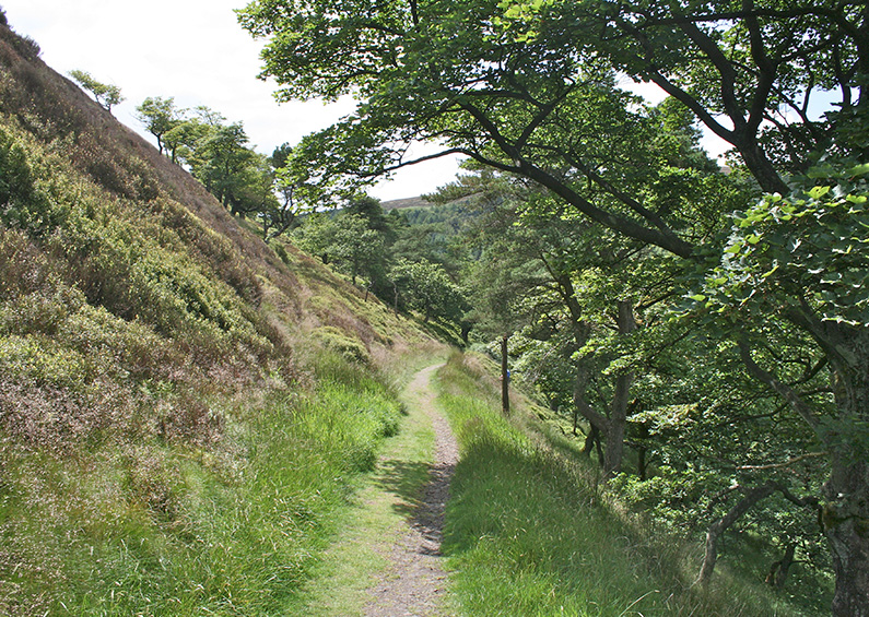
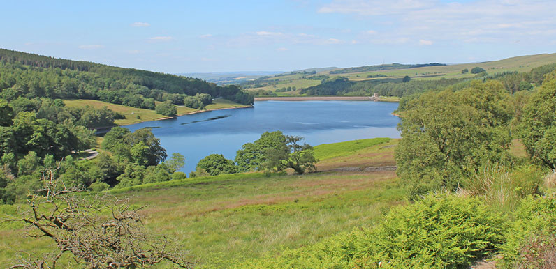
Goyt Valley walk 8: Shining Tor Walk distance: 6 miles | Date recorded: July 2011Start point: Errwood Hall car park | Google MapGPX file: Just £1.50 | Download file At just over six miles, this walk from Errwood Reservoir up to Shining Tor is one of the longest in the...
Oct 9, 2015
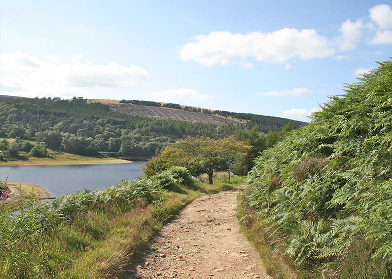
Goyt Valley walk 9: Buxton to Errwood Walk distance: 8 miles | Date recorded: July 2011Start point: Bishops Lane, Buxton (SK17 6UN) | Google MapGPX file: Just £1.50 | Download file This eight-mile circular walk starts at Burbage, on the western edge of Buxton, passing...
Oct 9, 2015
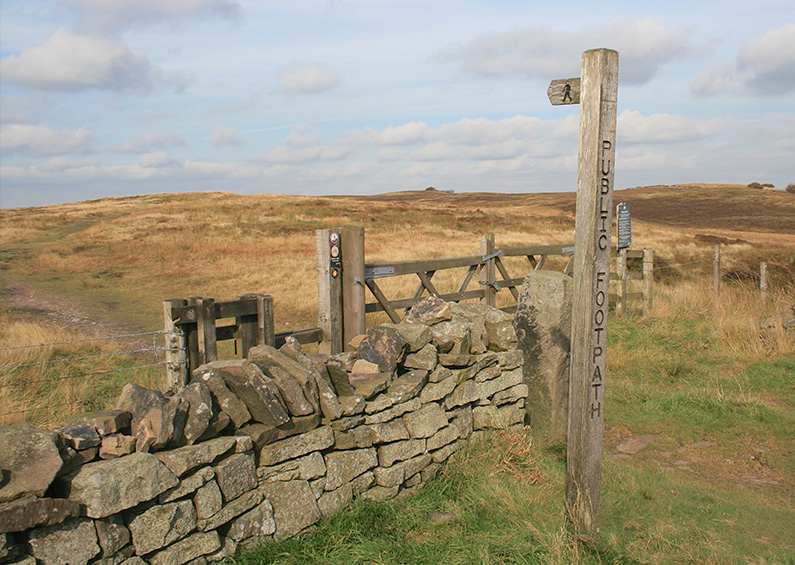
Goyt Valley walk 10: Old Goyt’s Lane Walk distance: 3 miles | Date recorded: August 2011Start point: Goyt’s Lane car park (SK17 6GJ) | Google MapGPX file: Just £1.50 | Download file This easy, three-mile circular walk follows the old lane which was once...
Oct 9, 2015
Goyt Valley walk 11: Derbyshire Bridge Walk distance: 3.5 miles | Date recorded: September 2011Start point: Derbyshire Bridge car park | Google MapGPX file: Just £1.50 | Download file Autumn has arrived here in the Goyt Valley, and the leaves are starting to turn from...
Oct 1, 2015 |
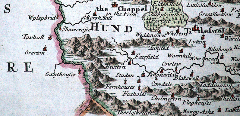
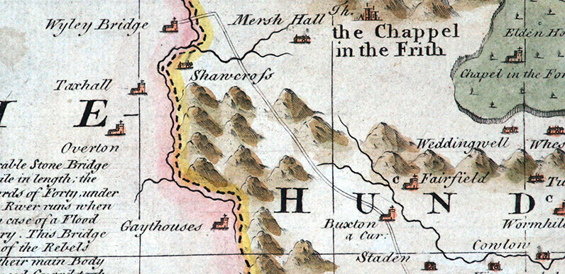
Above: Click the map to enlarge. Map courtesy of Copperplate Antique Maps. (Click to view a comprehensive stock of original antique county maps.) Robert Morden (1695) By Kevin Welch of Copperplate Antique Maps. This Derbyshire map is by Robert Morden. Morden was...
Sep 10, 2015
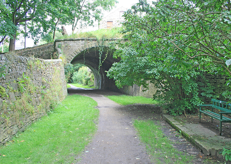
Goyt Valley walk 12: Cromford & High Peak Railway Walk distance: 9 miles | Date recorded: September 2011Start point: Buxton Pavilion Gardens car park (SK17 9AR) | Google MapGPX file: Just £1.50 | Download file At around 9 miles, this is one of the longer walks in...
Sep 1, 2015 |
Above: Click the map to enlarge. Map courtesy of Copperplate Antique Maps. (Click to view a comprehensive stock of original antique county maps.) Emanuel Bowen (1758) By Kevin Welch of Copperplate Antique Maps. This map is by Emanuel Bowen; one of the most prolific...
Aug 27, 2015 |
Goyt Valley walk 13: Errwood circular Walk distance: 5 miles | Date recorded: February 2012 (updated July 2019)Start point: Errwood Hall car park | Google MapGPX file: Just £1.50 | Download file There are some wonderfully panoramic views during this easy and enjoyable...
