Above: The moorland path snakes down the valley from the railway tunnel at 6 on the map.
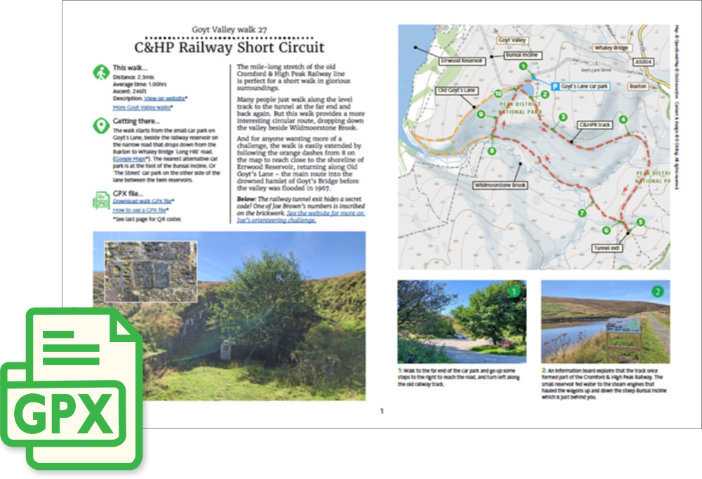
Click for a pdf with stage-by-stage details of the route including photos and a map, as well as links to car parks and public transport. A walking app GPX file is also available.
Length: 2.3mls | Av. time: 1hr | Ascent: 246ft
Start: Goyt’s Lane car park | Google Map
Walk description, map & GPX | Download
A 2.3-mile circular walk from the small car park on Goyt’s Lane, the narrow road that drops down from the Long Hill road between Buxton and Whaley Bridge. The nearest alternatives are the layby at the foot of the Bunsall Incline and The Street car park.
The mile-long stretch of the old Cromford & High Peak Railway is perfect for a short walk in glorious surroundings. The small reservoir beside the car park fed water to the steam engines that hauled wagons up and down the steep Bunsall Incline. It was also a popular spot for ice skating when it froze over.
Many people just walk along the level track to the tunnel at the far end and back again. But this walk provides a more interesting circular route, dropping down the valley beside Wildmoorstone Brook.
Along the way, the track passes a pair of twin embankments. I think the outer one must have been too sharp a bend once steam engines replaced horses, and it was replaced by the one that forms the track today.
The tunnel and Wildmoorstone Brook
The track ends at a blocked-up tunnel entrance – the longest tunnel on the railway that linked the canals at Cromford and Whaley Bridge. If you look hard enough, you’ll find one of Joe Brown’s Numbers carved on a brick in the stonework.
From here you could head up to Burbage Edge (walk 25) or on to Buxton (walk 9). Otherwise the path drops down the valley over a series of duckboards, with rectangular patches cleared on the far side so that fresh young shoots grow as food for grouse.
A short climb – the steepest part of the walk, and sometimes overgrown with ferns – leads back to the car park, past the top of Old Goyt’s Lane, once the main route into the drowned hamlet of Goyt’s Bridge.
For a longer walk, carry on at point 8 on the pdf map to the southern tip of Errwood Reservoir and return up Old Goyt’s Lane (walk 10), or even complete a circuit of the reservoir (walk 13).
Click for a pdf with stage-by-stage details of the route including photos and a map, as well as links to car parks and public transport. A walking app GPX file is also available.
Route photos
Stages 1-6 of the route. Click any to enlarge and scroll through.
Relive video
Click to play and use the expand option to view in full-screen. More Goyt Valley Relives.