A recently discovered set of numbers are similar to those on Joe Brown’s orienteering challenge. But these point to Errwood Bridge, which now lies under Errwood Reservoir.
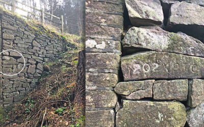
A recently discovered set of numbers are similar to those on Joe Brown’s orienteering challenge. But these point to Errwood Bridge, which now lies under Errwood Reservoir.
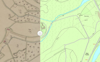
A detailed map published in 1832 for the sale of land in the Goyt Valley is the oldest I’ve seen. It must have been at this auction that Samuel Grimshaw purchased the land on which he’d build Errwood Hall.
An 1845 tithe map shows that Errwood Hall hadn’t yet been built, even though Samuel Grimshawe purchased the land some 13 years earlier. I thought work had started well before then.
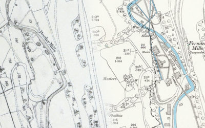
Comparing the recently discovered 1846 plans of the valley with OS maps from the 1890s reveal some fascinating changes, but also poses the question of when Grimshaw turned to Grimshawe.
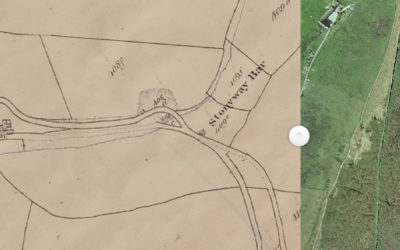
Alec has discovered a wonderful website that reveals a lot about the history of the Cheshire side of the Goyt Valley. Including the position of the second Stonyway Toll House.
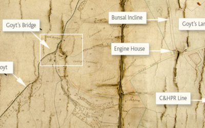
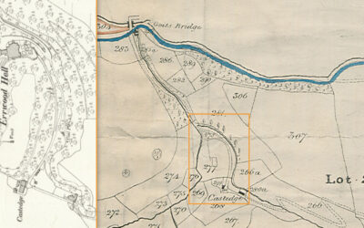
Recently discovered in the Devonshire Collection at Chatsworth House; the earliest detailed map of Goyt’s Bridge, dated 1853. Drawn some 10 years after the completion of Errwood Hall.
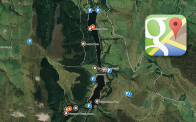
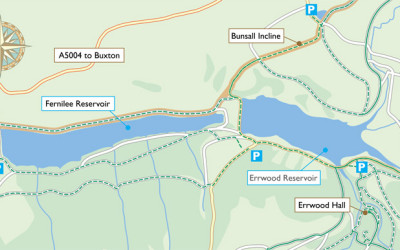
I’ve been testing Google Maps to plot all the lost farms, places of interest and car parks in the Goyt valley – and it seems to be working well. Next stage is to add the various walks.
Now lying under Errwood Reservoir, Goyt’s Bridge was once an idyllic spot, attracting visitors from far and wide. But what of its history before the tourists arrived? Old maps can offer a few clues…
I’ve finally managed to create maps and instructions for the 12 Goyt Valley walks featured on this website. I’ve also redesigned the site to make it easier to view on mobile devices like smart phones.