Oct 17, 2017 |
Michael’s Goyt Valley postcards My thanks to Michael Baines for kindly allowing me to scan some of his wonderful collection of Goyt Valley postcards. Many of his cards are already featured on the website, so I’ve only included those that don’t appear...
Jan 19, 2017 |
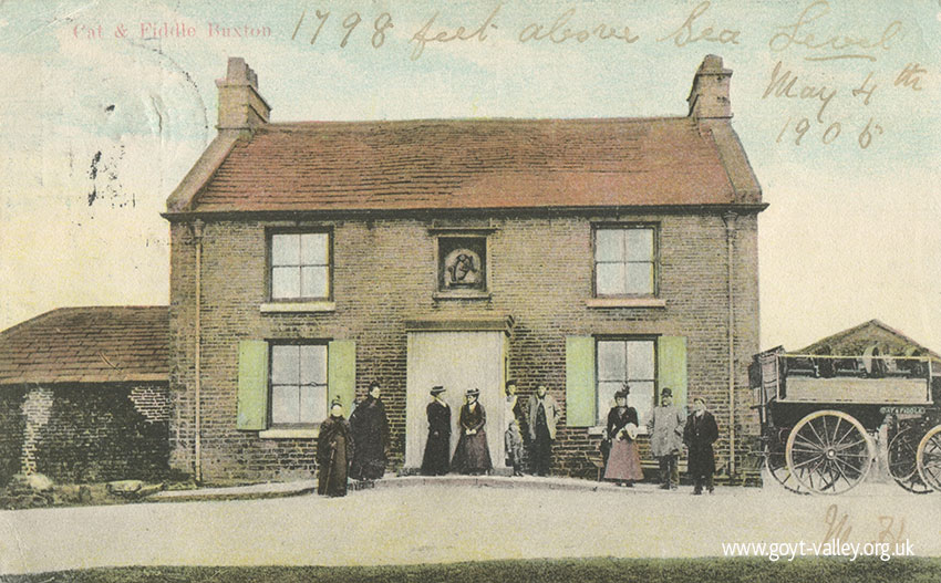
The Cat & Fiddle Pub Many thanks to Corrie for allowing me to scan her collection of old postcards showing the famous Cat & Fiddle pub. Standing close to the source of the River Goyt, it was on the edge of the Grimshawe’s Errwood Estate. The...
Jan 15, 2017 |
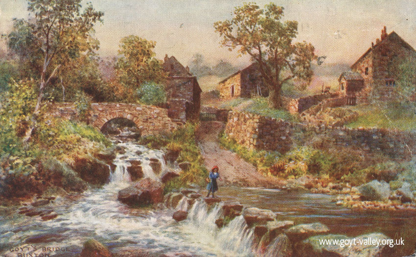
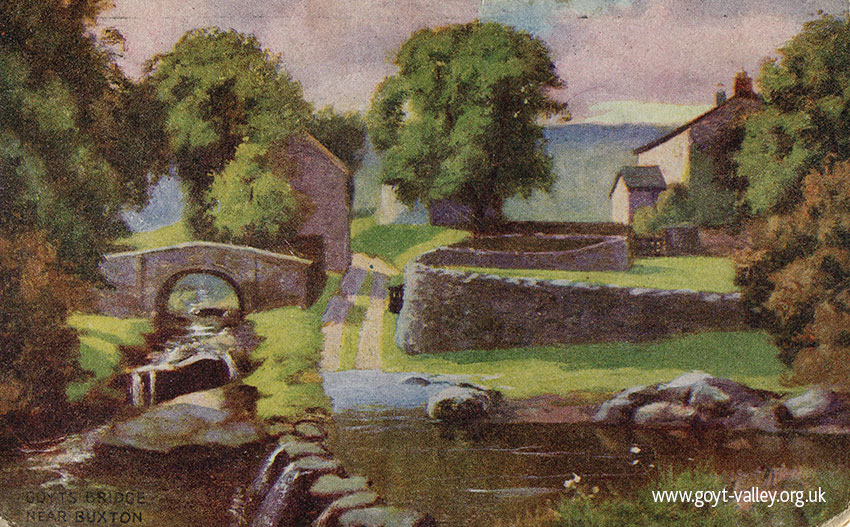
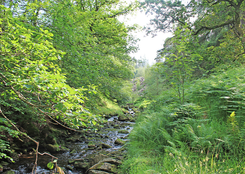
Corrie’s postcards All the postcards shown here were kindly sent to me by Corrie. They feature the drowned hamlet of Goyt’s Bridge, as well as the Goyt all the way from Derbyshire Bridge to Taxal. Click on any image to...
Jan 8, 2017 |
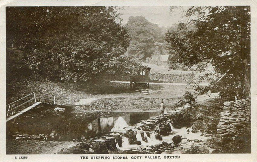
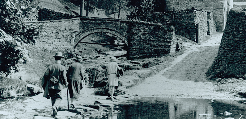
Above: I’ve highlighted the camera view in green. The photographer was standing beside the small packhorse bridge, alongside Wildmoorestone Brook as it joins the River Goyt. Goytshead Farm is just behind. The stepping stones #1 Many thanks to Mike for...
Mar 24, 2016 |
Goyt Valley walks maps I created these maps to fill the screen of a typical smart phone, which is why north points in different directions. Click any heading to view detailed step-by-step directions and photos, plus a short ‘Relive’ video. And...
Mar 2, 2016 |
Goyt’s Bridge views A collection of general views of Goyt’s Bridge; the small hamlet which now lies submerged at the southern end of Errwood Reservoir. Simply click on any image to enlarge, and then scroll through the collection using the arrow keys...
Jan 1, 2016 |
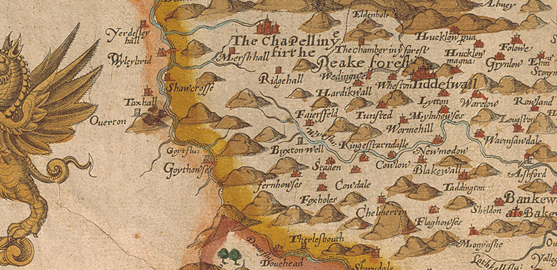
Above: This is the very first representation of Goyt’s Bridge – then known as Goythowses (Goyt Houses). Click the map below for a closer view. Above: Map of Derbyshire 1577 by Christopher Saxton (c1543 – c1610). © Devonshire Collection,...
Dec 1, 2015 |
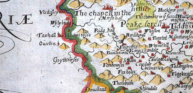
Above: First issued in 1607, this image is copied from the 1637 edition of Camden’s Britannia. Above: Click the map to enlarge. Map courtesy of Copperplate Antique Maps. (Click to view a comprehensive stock of original antique county maps.) William Hole (1607)...
Nov 1, 2015 |
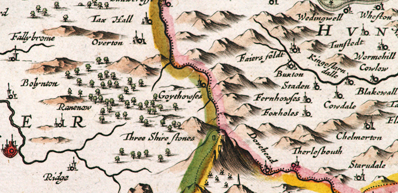
Above: First issued in 1646, this image is copied from Jan Jansson’s ‘Atlas Novus’. Above: Click the map to enlarge. Map courtesy of Copperplate Antique Maps. (Click to view a comprehensive stock of original antique county maps.) Jan Jansson (1646)...
Oct 9, 2015
Goyt Valley walk 1: The Riverside Walk distance: 2 miles | Date recorded: March 2011 (updated July 2019)Start point: Errwood Hall car park | Google MapGPX file: Just £1.50 | Download file This short walk is probably the easiest in this series, but includes one of the...
