May 17, 2019 |
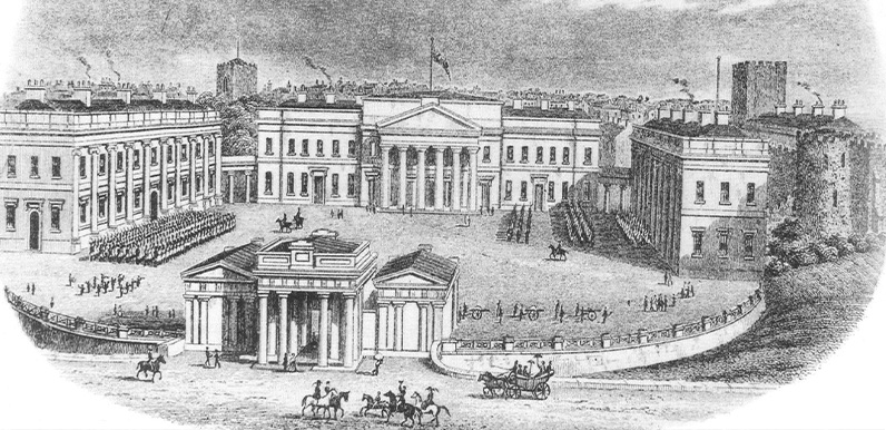
Above: The conditions for prisoners at Chester Castle, where Joseph Dale stood trial for the murder of William Wood, were said to be extremely harsh. The trial of Joseph Dale for the murder of William Wood took place at Chester Castle. One of his co-accused,...
May 16, 2019 |
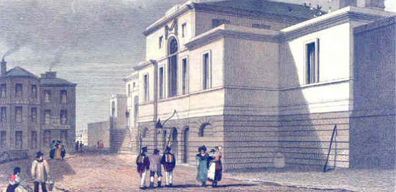
Above: Both suspects were incarcerated within the grim walls of Manchester’s New Bailey Prison. The previous post covered the arrest of one of the murder suspects, 17-year-old Charles Taylor, in a Manchester pub. And the escape of his two co-accused,...
May 15, 2019 |
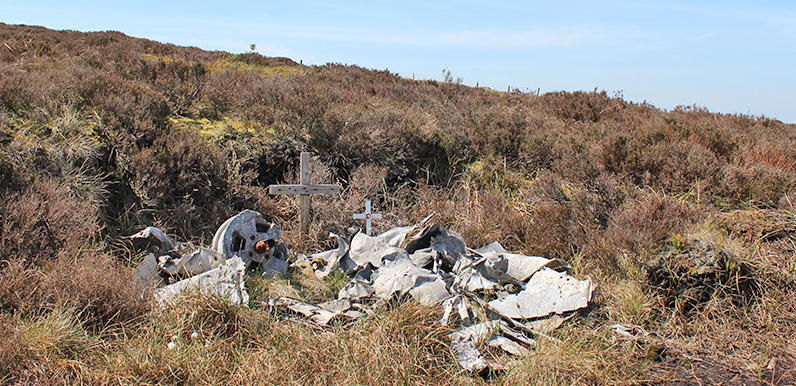
Above: The poignant remains of a training aircraft that crashed close to Shining Tor in 1944. It’s said that the three crew survived – only to die of exposure some days later. Above: The first part of the plane I came across was this metal casing (click to...
May 14, 2019 |
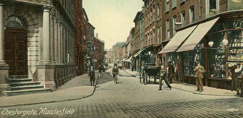
Above: Chestergate is one of Macclesfield’s oldest streets. It was here that witnesses reported seeing the youngest of the three accused purchasing ‘three complete suits of cloathes’. Before moving on to buy ‘shoes &c’ from Mr....
May 13, 2019 |
Above: William’s body was taken on the back of a cart to The Cock public house. And this is where the inquest was held, just three days later. By the time this photo was taken it had been renamed The Jodrell Arms. The pub has been in a very sorry state...
May 13, 2019 |
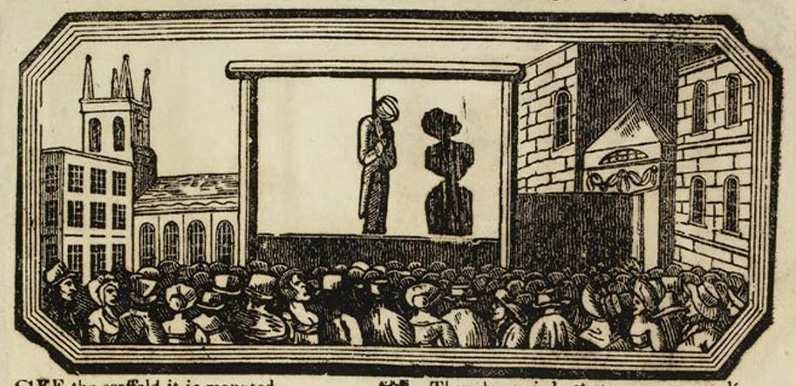
Above: Public executions once attracted huge crowds of ghoulish spectators. The last one in England took place in 1868, some 45 years after 17-year-old Joseph Dale met such a fate. Following on from the recent post about the Murder Stone lying beside the back road...
May 11, 2019 |
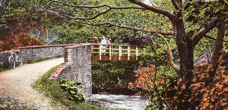
Above: Another image from the Whaley Bridge Photos website showing the bridge over the Goyt at Taxal. Judging by the hand colouring, and the ladies’ clothes, I’d have guessed it was taken in the early 1900s. But the bicycle looks closer to the 1930s....
May 2, 2019 |
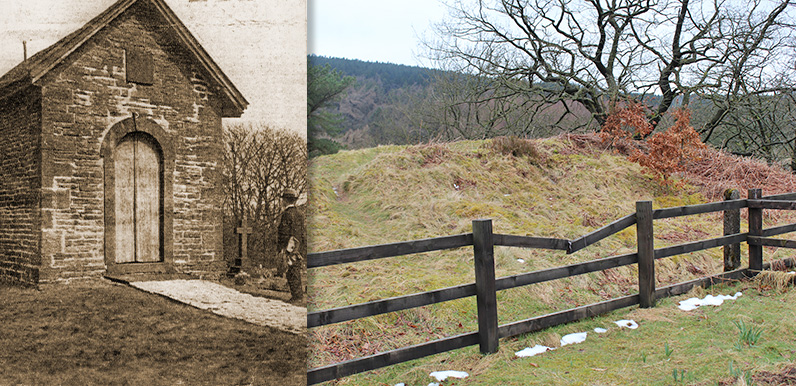
Above: The Grimshawes’ family cemetery lies above the ruins of their grand country house, Errwood Hall. At one time there was a building to the left, with a vault below, which would have held the coffins of family members (above left). And it...
May 2, 2019 |
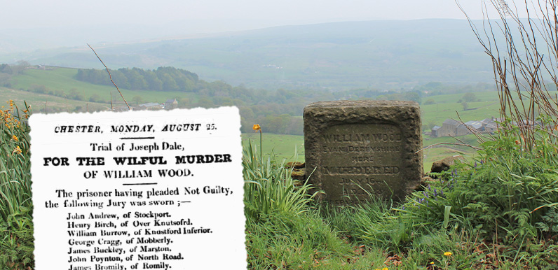
Above: The Murder Stone was erected in memory of William Wood at the very spot his brutally mutilated body was discovered, back in 1823. Above: The stone isn’t easy to find. This shows its position on my phone’s map app (click to enlarge). It’s on...
Apr 30, 2019 |
Above: Errwood Hall pictured in its prime. The Grimshawes were certainly a very weatlthy family. So perhaps it’s not surprising that there were rumours of buried treasure! My thanks to R. S-S from the Whaley Bridge Local History Forum for this wonderful...
