Nov 16, 2020 |
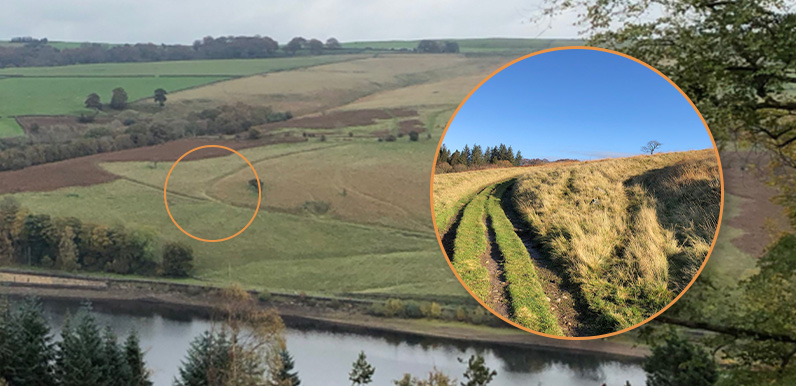
Above: This view across the reservoir has only opened up since the felling of the fir trees. I’ve circled the junction of the twin tracks, with the ancient holloway running up the slope on the right. The recent felling of the fir trees on the western slopes...
Jun 10, 2017 |
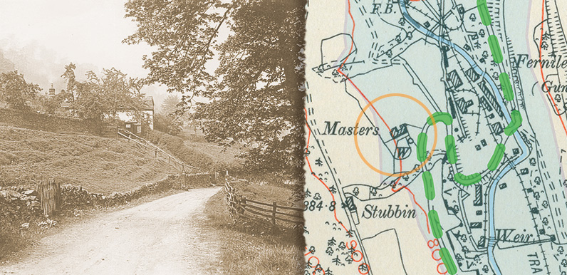
Above: The green dashes show the road from Goyt’s Bridge as it passes Masters Farm (above left and circled on the map) and winds down the valley towards the nearby Gunpowder Mill, and on to Fernilee and then Whaley Bridge. The blue area shows the...
Oct 27, 2016 |
Above: This 1890 OS map (click to enlarge) shows both the Old Goyt’s Lane road into Goyt’s Bridge, and the Bunsall Incline. The area shaded pale blue shows Errwood Reservoir today. I’ve marked where I thought the photo must have been taken. And the...
Feb 29, 2016 |
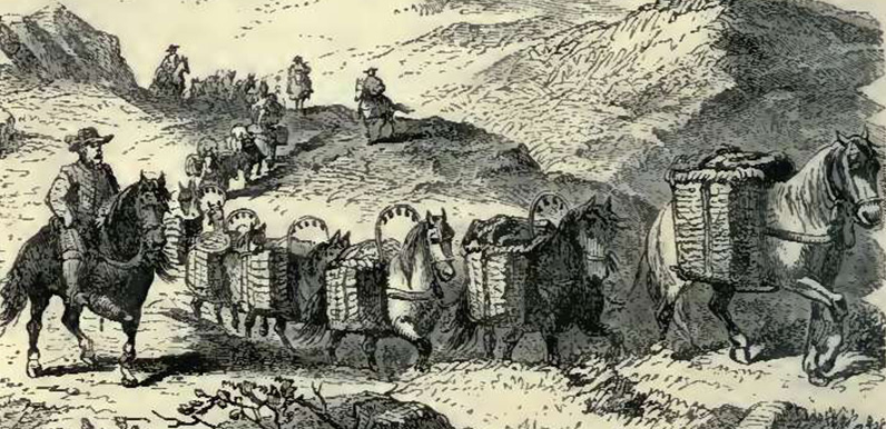
Above: A Victorian illustration of a 16th century packhorse train making its way across the Pennines. The bells hanging above the horses’ panniers could be heard from some distance. Above: This 17th century map shows Goyt’s Bridge as Goythowses (click to...
Feb 24, 2016 |
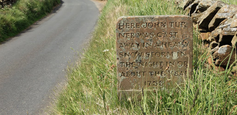
Above: Photo by Simon Butler. Above: The reverse of the stone (click to enlarge). Just who was the lady who left a frozen footprint in the snow beside the dead body? (Photo Dr. Tony Shaw.) Above: A wonderful woodcut illustration of Saltersford Hall Farm by Howard...
