Apr 10, 2019 |
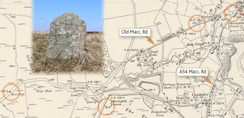
Above: One thing I learned from last week’s talk is that MS stands for milestone and MP for milepost. And that posts were typically metal and superseded the stones. This map shows that stones were set beside the earlier turnpike, and posts on the later...
Apr 9, 2019 |
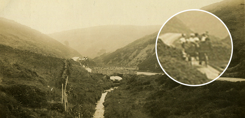
Above: A group of travellers in a horse-drawn carriage cross Derbyshire Bridge on their way north through the Errwood Estate. The photo probably dates to around the end of the 19th century. This narrow road between Goyt’s Moss and Whaley Bridge was known as...
Apr 4, 2019 |
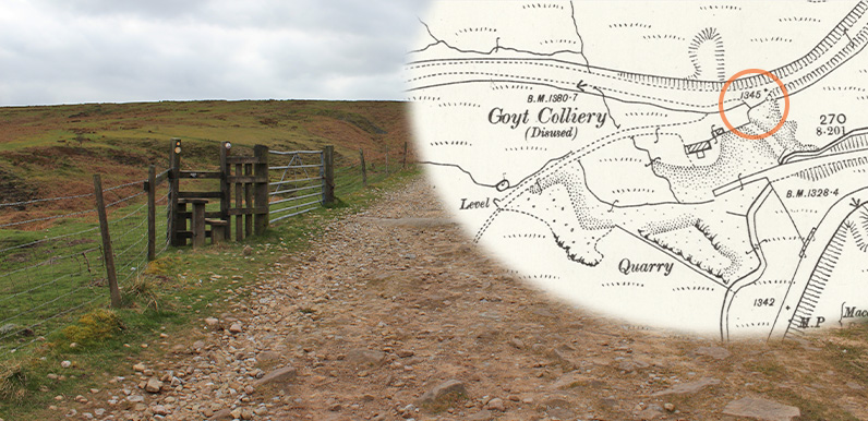
Above: A small stile from the Old Macclesfield Road, just on the outskirts of Burbage, leads down to the site of what was once a busy colliery. The inset map dates back to the late 1890s and shows the colliery was already disused at this time. I find it fascinating to...
Apr 2, 2019 |
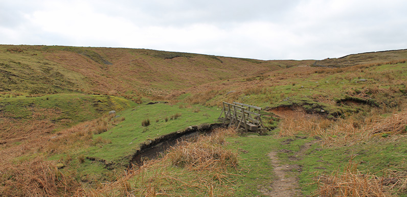
Above: It’s difficult to imagine today, but this area was once a busy drift-mining colliery. Coal was unloaded from small canal boats at the head of a drift tunnel in the hillside, just a short distance from this bridge, and loaded onto railway wagons, as...
Mar 20, 2019 |
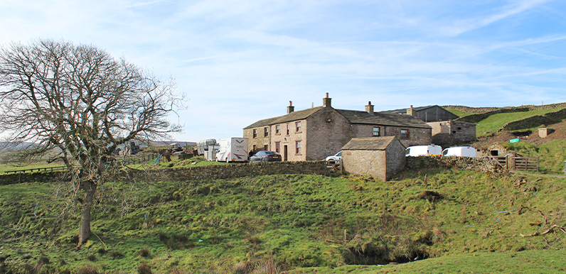
Above: Long Hill Farm lies on the left, just before the sign to the Goyt Valley on the road from Buxton. Above: Could this have been the very spot that Farmer Thomas Dunn lost his life (click to enlarge)? It’s certainly been strongly reinforced over the years....
Mar 18, 2019 |
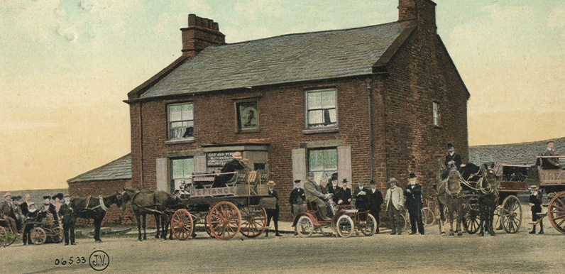
Above: This photo taken at the Cat & Fiddle probably dates to the 1910s – around the same time Fredrick found himself in trouble with the law – and shows various forms of transport, including an early car as well as some horse and traps. Another gem...
Mar 16, 2019 |
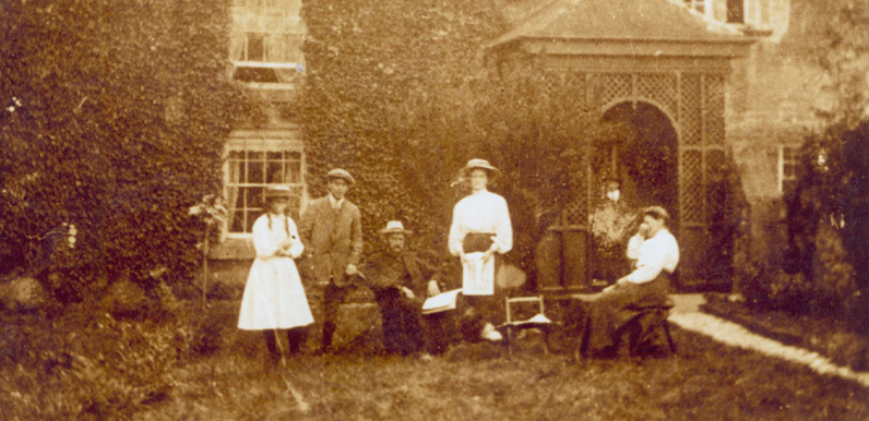
Above: This photo shows a family posing outside Nook Farm and was probably taken in the early 1900s. Census records show the Dunns had left the farm sometime between 1891 and 1901, so it’s unlikely they’re the family posing here. My thanks to Mike for...
Mar 14, 2019 |
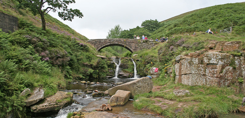
Above: A photo taken in summer from Pannier Pools up to one of the two packhorse bridges at Three Shires Head. The name came from the pannier bags slung across either side of the packhorses. It’s been a while since I’ve added another walk to the series (up...

Mar 11, 2019 |
Above: Andy Twigge is a popular DJ on BBC Radio Derby. https://www.goyt-valley.org.uk/wp-content/uploads/2019/03/Radio-Derby-interview-March-2019.mp3 BBC Radio Derby DJ, Andy Twigge, is running a regular A to Z feature on places of interest in Derbyshire and...
Feb 22, 2019 |
Join the Facebook conversation on everything to do with the Goyt Valley by clicking this link. I have a guilty admission; I’m rubbish at social media. I’ve had a Facebook page for years, but like many others of my generation (just past retirement age), I...
