Above: The Goyt once divided Cheshire and Derbyshire, which is how Derbyshire Bridge got its name. One of Joe’s clues is inscribed on the stonework.
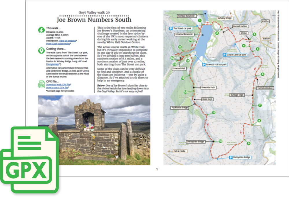
Click for a pdf with stage-by-stage details of the route including photos and a map, as well as links to car parks and public transport. A walking app GPX file is also available.
Length: 8.4mls | Av. time: 3.50hrs | Ascent: 1115ft
Start: The Street car park | Google Map
Walk description, map & GPX | Download
An 8.4-mile circular walk from The Street car park, beside the dam between the two reservoirs. Other car parks on the route include Errwood Hall, Derbyshire Bridge and Goyt’s Lane, beside the small reservoir at the top of the Bunsall Incline.
This is the first of two walks following Joe Brown’s Numbers, an orienteering challenge created in the late 1960s by one of the UK’s most respected climbers, when he worked at the nearby White Hall Outdoor Centre.
Joe designed it as one route, starting from White Hall, but it’s almost impossible to complete in a day if you’re searching for the clues. So I’ve split it in two – this southern half, and a northern half of 11.5 miles (walk 30), both starting from The Street.
Some of the clues can be very difficult to find and decipher, and a couple are wrong – one by quite a distance. So the pdf includes a crib sheet to help in an emergency. See also Navigating Joe Brown’s Numbers.
Burbage Edge and Derbyshire Bridge
The walk climbs the Bunsall Incline on the old Cromford & High Peak Railway, then crosses moorland to Old Goyt’s Lane and a small shrine. One of Joe’s clues is close by, but it’s not easy to find!
It drops down to the old railway line and the blocked-up tunnel entrance, then climbs to the trig point on Burbage Edge, with views over Buxton, before crossing a bleak and often very muddy stretch of moorland towards the Cat & Fiddle.
The old turnpike road leads down to Derbyshire Bridge, an ancient crossing point over the Goyt. The lane then follows the river – traffic is one way, coming towards you – before the Riverside Path heads on towards Errwood.
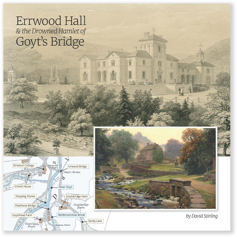
The return passes the ruins of Errwood Hall and the steps up to the Grimshawes’ graves, then follows the road beside Errwood Reservoir, where the remains of Goyt’s Bridge lie under the water. My book tells the story of the hamlet, the hall and the Grimshawe family.
Click for a pdf with stage-by-stage details of the route including photos and a map, as well as links to car parks and public transport. A walking app GPX file is also available.
Route photos
Stages 1-6 of the route. Click any to enlarge and scroll through.
Relive video
Click to play and use the expand option to view in full-screen. More Goyt Valley Relives.