Using ViewRanger
At the start of 2020 I put all the Goyt Valley walks featured on this website onto the ViewRanger app. (See blog post).
For anyone who hasn’t used ViewRanger, it’s free (although there is a paid-for version that comes with a few more bells and whistles). And although it’s possible to purchase detailed OS maps, ViewRanger’s free versions are fine for these walks.
I’ve put the walks across four pages – six on each. They’re all numbered exactly as they appear under the ‘Choose a walk‘ page…
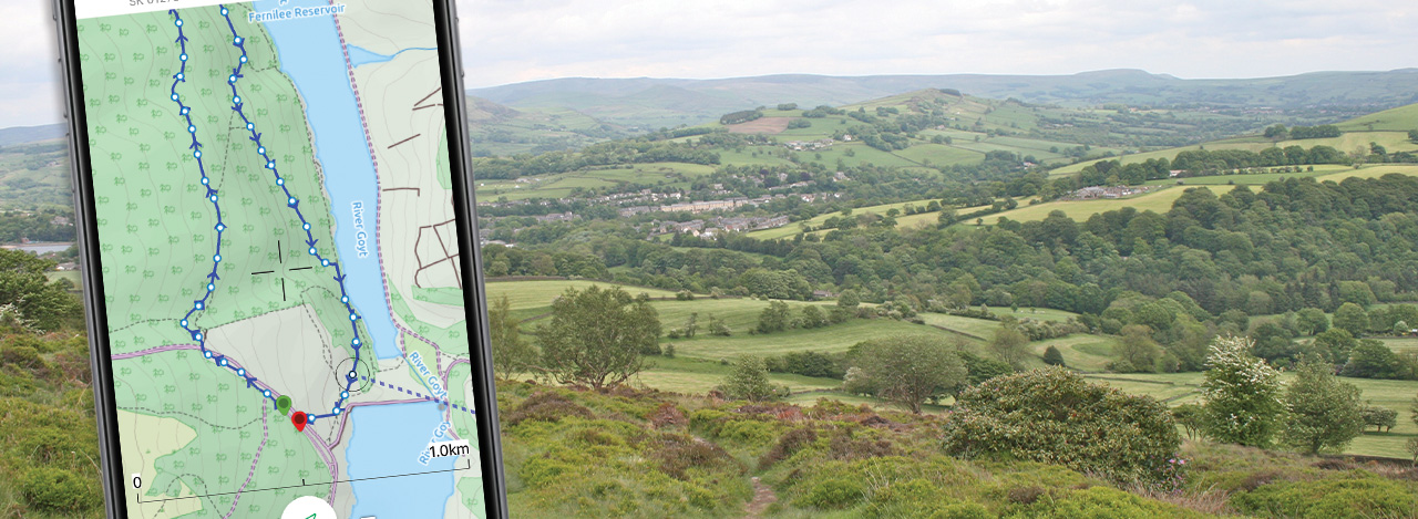
The example shown on this page is walk 4; an easy 3-mile stroll from Errwood Hall carpark up to the ruins of Errwood Hall, and then onto St Joseph’s Shrine. Clicking the ‘Open in the ViewRanger app’ button will enable you to open a free ViewRanger account, and then follow the walk on a smartphone.
You’ll need an internet connection – or decent phone signal – to download the app. But you won’t need these to follow the walks as it uses GPS (Global Positioning Satellites).
Taking you to the start point
As well as guiding you around the walk, the app will take you to the starting point using your phone’s inbuilt mapping system, such as Google Maps or Apple’s Maps.
My only advice – if your phone is like mine and needs charging more than once a day – would be to get a portable phone charger, in case your battery dies. And maybe a weather-proof case if you’re likely to use it in the rain.
View all walks on ViewRangerViewRanger has also grouped all the Goyt Valley walks on their app. Click above to view them.
Feedback on using the app would be very much appreciated. And I’m happy to help with any advice. Please use the contact page to get in touch.
Page update: June 2021: ViewRanger has been taken over by OutdoorActive. Click for details.