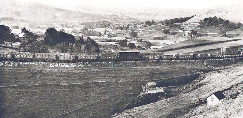
It’s a view across Burbage, southwest of Buxton. It’s just possible to make out Buxton’s famous dome in the far distance.
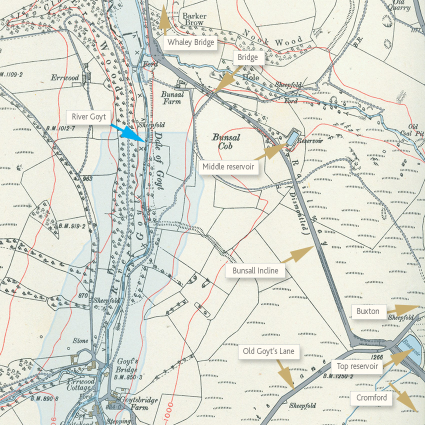
Above. This 1912 map (click to expand) shows the Bunsal Incline on the old Cromford & High Peak Railway line, and the small reservoirs used to feed the steam-powered pulleys which hauled the trains up and down the steep slope. Today the incline forms the main entrance into the Goyt Valley.
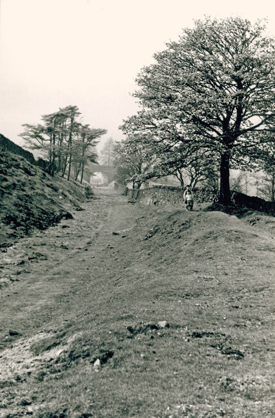
Above: The Bunsal Incline after the track had been removed, but before it was tarmacked (click to enlarge).
Below: Another photo of the incline before it was tarmacked, looking up the slope. The area on the left is a small carpark today.
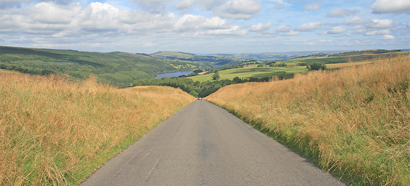
Above: Today, the Bunsal Incline provides a wonderful entrance to the glories of the Goyt valley.
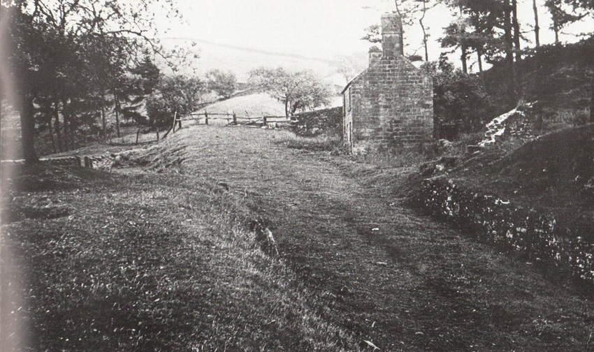
This straight section of road was only tarmacked in 1967. Before then the route into the valley forked left along Old Goyt’s Lane (see map left), down towards Goyt’s Bridge.
It was the longest of six inclines on the Cromford & High Peak Railway, and known as the ‘Bunsal Incline’. Wagons were hauled up and down these steep stretches of railway using steam-driven cables and counterweight wagons.
Opened in 1831, this 33 mile railway connected the Cromford Canal with the Peak Forest Canal in Whaley Bridge. It was a triumph of Victorian ingenuity and determination to join these two important canals over this bleak and challenging terrain.
Cromford was the birthplace of the Industrial Revolution. And it was vital for the wealthy and enterprising industrialists to get their goods to the fast-growing cities of the Northwest. And then on to the ports of Manchester and Liverpool which would carry them to the rest of the world.
A two-day journey
But the inclines slowed the journey time down considerably; when first opened it took two days from start to finish. The most difficult section of the line between Ladmanlow, near Buxton, through the Goyt Valley towards Whaley Bridge, was abandoned in 1892 when an easier route was opened. The tracks were removed and for the next 75 years the line became a useful path for villagers, traders and farmers.
The valley was purchased by Stockport Corporation in 1930. Fernilee Reservoir was completed in 1937. The Bunsall Incline was tarmacked shortly before Errwood Reservoir was officially opened in 1968 to form the main route into the valley. There is still evidence of the railway – if you know where to look.
Two small reservoirs – one at the top and one half-way down – provided water for the steam engines and pulleys. The middle one is difficult to spot amongst the undergrowth, but the one at the top provides an excellent spot for picnics – and was used as a winter ice rink during Victorian times.
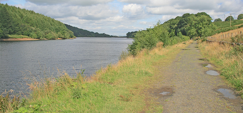
One of the most popular walks in the Valley is along the eastern shore of Fernilee Reservoir. It’s solid, level surface provides an ideal path in all weathers, with car parks at either end. But not many visitors realise it was once a railway track.
I’ve traced the northern section of the railway – as far as possible – in my Walk 12 which goes between Burbage on the outskirts of Buxton all the way to Whaley Bridge, a distance of some 15 miles (although it can be shortened by starting from either Errwood or Fernilee Reservoir). The return is by a regular train journey between the two towns.
Over the High Peak Railway
Click here to read a report of a journey along the entire route in 1880, from Whaley Bridge all the way to Cromford.

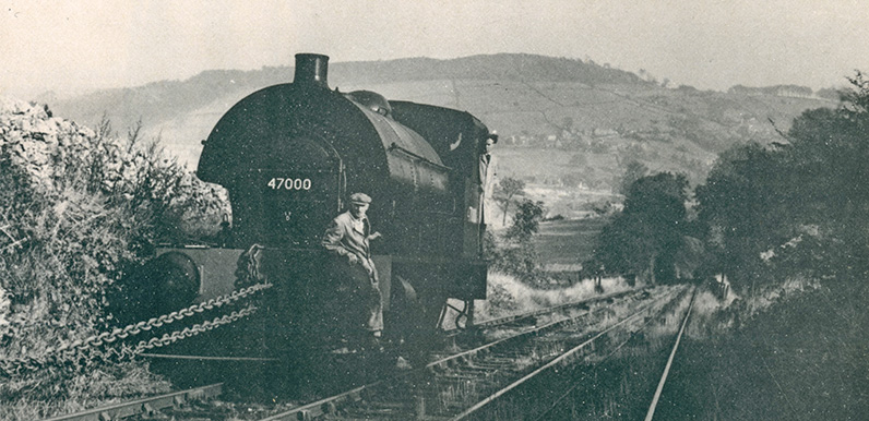
The locomotive pictured on Whaley Bridge incline has a British Railways number, so the photo must have been taken after nationalisation (in 1948).
Looking at it again, are you sure it’s Whaley Bridge incline?
Thanks for the info, John. I’m not sure it’s the Whaley Bridge Incline. But it does appear to be Whaley Bridge in the background. And I thought this was the only incline that survived until so late. But I’m happy to stand corrected…
I think it’s Middleton incline. Although these engines were used more on the Sheep Pasture to Middleton Bottom section. The reason i think it’s Middleton and not Sheep Pasture incline, is the bridge in the background. That’s towards the Southern end of the line nearer Cromford.
I think Derek is right about it being Middleton incline. If you click this link, and scroll through, you can find one or two pictures taken from a similar angle.
Thanks for getting in touch, Derek. That seems to make sense. I’ll change the caption.
I may be a bit late with this but this is indeed Middleton Incline. My friends and I used to play around the bottom of the incline and hitch a ride on the trucks being taken over to sheep pastures, jumping off at Black Rocks for a spot of climbing! Black Rocks is on the extreme left of the photo with Barrel Edge in the centre.The houses are on Oakerthorpe Road, Bole Hill and to the right (out of view) is Wirksworth.
The loco is being dropped down the Middleton Incline. It suffered damage when the points at Steeplehouse were left set wrong and the loco ran down the bank into the neighbouring garden. The driver and fireman had a lucky escape by jumping off at the last moment when seeing the points set wrong. The loco was going back into service after repairs. This was in 1955.
Yes I agree with Bill and Alan that it is Middleton incline. I remember this engine in particular was shedded for some time at Sheep Pasture as in my youth I used to get into the shed on a Sunday and have a play.
The engine shown above could have been the one that waited at the top of the Sheep Pasture Incline. I remember, in the early sixties, the winching arrangement was changed to electricity. We built an 11000 volt overhead line from the substation at the top of Cromford Hill across the fields to a substation next to the engine house. Sadly by this time I do not think there was a lot of traffic and I doubt the electric system was hardly ever used.