Two Alexanders were responsible for the design of Errwood Hall: Roos the young and talented architect, and the wealthy Beresford-Hope who recommended him to his friend Samuel Grimshawe.
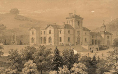
Two Alexanders were responsible for the design of Errwood Hall: Roos the young and talented architect, and the wealthy Beresford-Hope who recommended him to his friend Samuel Grimshawe.
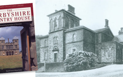
A description of Errwood Hall in a popular coffee-table book says it’s “probably the most romantic location in Derbyshire”. It contains some fascinating details, but quite a few inaccuracies.
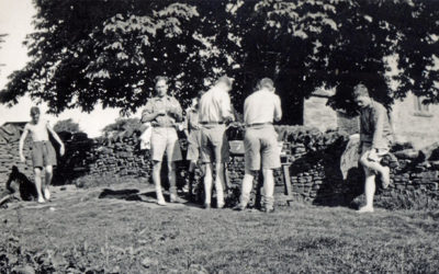
A photo of a derelict building known as Boothman’s Cottages recently came to light. There’s nothing left of it today. Was it connected to coal mining, or simply a stop-off point for weary travellers?
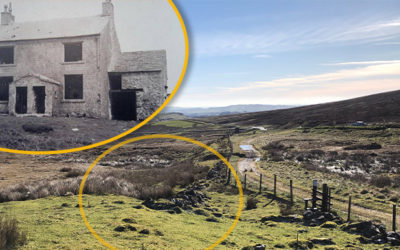
Another long-held theory of mine goes up in flames, thanks to the discovery of yet another old photo from the archives; the Grimshawe’s hill-top vault wasn’t where I’d always thought it was.
Two bridges – both close to Errwood Hall. One that I’d never seen before, and another which I wasn’t sure ever existed. All it needed to solve the mystery was a pair of wellington boots.
Creating the new augmented reality app has posed some intriguing questions, and also unearthed some wonderful old photos. Putting both together is a challenging but fascinating project.
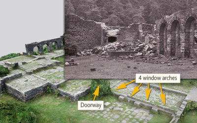
The augmented reality app which will bring the ruins of Errwood Hall to life is still at the planning stage. The first step is to identify the layout of the rooms. Any help would be much appreciated.
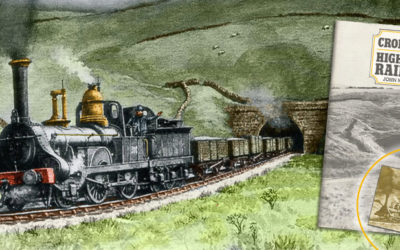
Thanks to the internet, social media and digital wizardry, we’ve transformed a poor-quality photocopy image of a train exiting Burbage Tunnel into something resembling the original painting.
I’d always understood that Errwood Hall was used as a Youth Hostel for a couple of years after Mary Grimshawe’s death in 1930. But according to recently discovered YHA records, that’s not correct.
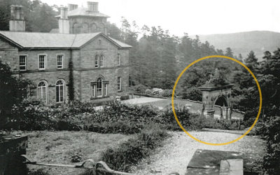
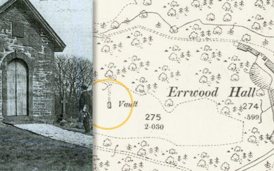
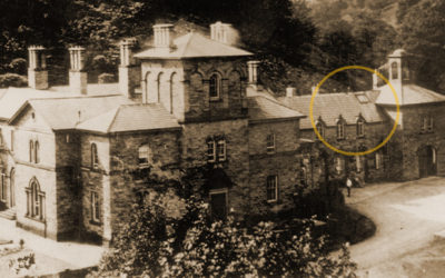
A recently discovered photo of Errwood Hall shows the grand arch which once formed the gateway to the Grimshawe family’s hill-top cemetery. The arch has long since gone, but the steps remain.
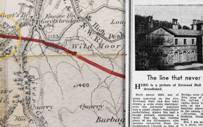
A 1941 press clipping explains that Samuel Grimshawe once blocked plans to create a railway through the Goyt Valley. But since it would have passed through Errwood Hall, it’s perhaps not surprising!
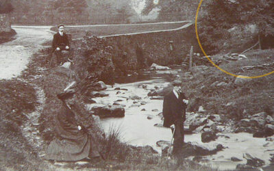
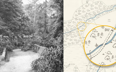
An old postcard recently appeared on ebay captioned ‘Goyt Valley’. But I really struggled to work out where it was taken. Sharper eyes than mine spotted a bridge arch hidden by trees. Mystery solved!
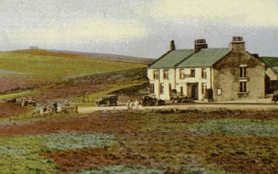
TV and radio historian Michala Hulme charts the intriguing fortunes of the famous Cat & Fiddle Inn, perched high on windswept moorland, close to the source of the River Goyt.
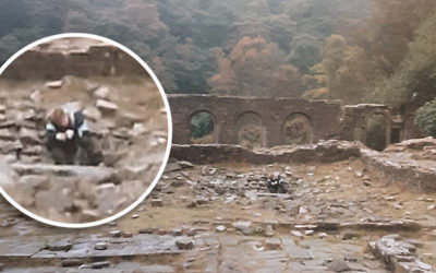
A recently discovered photo taken in 1988 shows a young boy peering into a hole in the centre of the Errwood Hall ruins. I wonder whether it might be the entrance to the cellars.
Three old photos recently popped up on ebay, captioned ‘Goyt Valley 1950s’. But where were they taken, and was the date correct? There’s only one man who knows the answer…
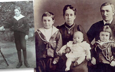
Two new photos said to be of Joseph Oyarzabel – son of Samuel Grimshawe’s butler – pose more questions than answers. Any help to discover the facts would be appreciated.

A virtual reality app designed to bring the ruins of Errwood Hall back to life is an exciting project. But you have to wonder what Samuel Grimshawe would have made of it.
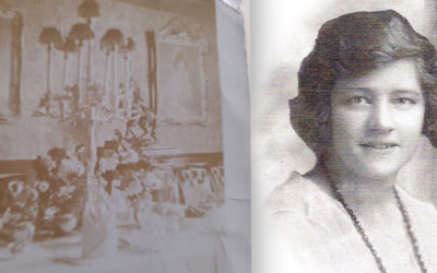
A fairly dull and faded photo of a well-dressed dining table is only the second image that’s come to light taken inside Errwood Hall. So it has a lot of historical interest and value.
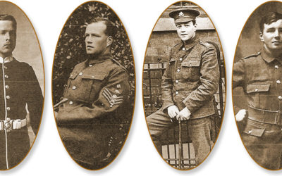
Gunpowder Mill worker, Allen Heather, and his wife Annie, had four sons and five daughters. All of them went to Goyt’s Bridge School. And one paid the ultimate sacrifice during WW1.
I’ve made a start at adding the final three houses to the the list of those demolished in the 1930s, following the purchase of the Errwood Estate by Stockport Corporation to build the twin reservoirs.
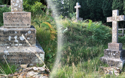
One of the graves at the Grimshawe’s hill-top cemetery has always intrigued me. Elizabeth Braddock was just 19 when she died. She must have earned a special place in the hearts of the Grimshawe sisters.
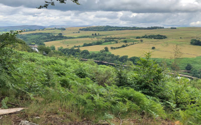
It’s now a year since the Forestry Commission started cutting down great swathes of larch in the valley. It opened up some wonderful views, but it doesn’t seem they will last long.
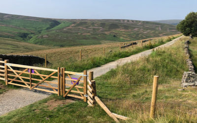
The mystery over the fencing that appeared along the old railway track seems to have been solved. A display board explains that it’s part of a scheme to reintroduce sheep.
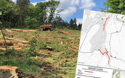
The Forestry Commission has begun the second phase of tree felling in the valley to tackle the outbreak of phytofra, this time to the west and south of Errwood Reservoir.
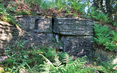
Could some large niches carved into a small area of exposed rock opposite Errwood Hall be evidence of a shelter – or perhaps even a shrine used by the staunchly catholic Grimshawes?
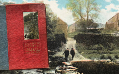
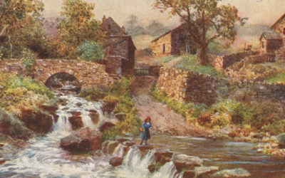
I recently came across a book called ‘Pictures in Colour of Buxton and the Peak District’. Published in the early 1900s, it includes three photos taken in and around the Goyt Valley.
A recording of a recent 40-minute Zoom presentation on the history of the Goyt Valley using some of the many photos and maps I’ve managed to collect over the years for this website.
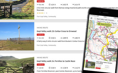
My favourite walking app, ViewRanger, is being taken over by a new one – OutdoorActive. I’ve transferred all the Goyt Valley walks over, so I’m hoping it’s as reliable as the old app.
Starting from Buxton’s famous Crescent, this walk passes through both the Pavilion Gardens and Serpentine Walks before rising up to Burbage Edge, along the southeast border of the Goyt Valley.
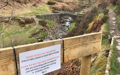
It’s sad to see that the picturesque packhorse bridge at Goytsclough has been closed due to some of the stonework collapsing into the Goyt. I’m hoping United Utilities don’t take long to repair it.