Feb 17, 2018 |
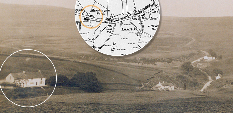
Above: This rare photo shows the old Macclesfield to Buxton road as it snakes towards the horizon. The circled house is Marchington Farm. The next building is Moss House. Further along on the right is Moss Hall, and lastly Goyt’s Moss Farm, which now serves as a...
Feb 16, 2018 |
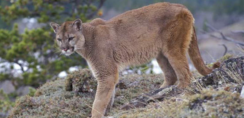
Above: Could a puma be living in the Valley? I’d say it was extremely unlikely. Above: A wallaby pictured in March 2009 near Lud’s Church by Andy Burton of Sheffield. Alan has sent a message posing what he says may seem a very odd question: Has...
Dec 12, 2017 |
I’ve taken a look at the drone on the maker’s website and it does look fairly idiot-proof. Which it would need to be if I’m not to drop such an expensive bit of kit in the middle of Errwood Reservoir! With Christmas fast approaching, I thought it...
Nov 6, 2017 |
Above: This suave gentleman features in the video (click to enlarge). He is Captain Preston, who married the younger Grimshawe sister, Genevieve, in 1891. He’s pictured on the steps leading up to the family’s hill-top cemetery – which is where he now...
Nov 5, 2017 |
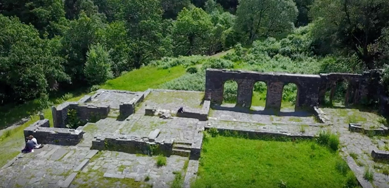
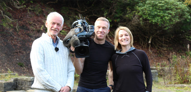
Above: Yours truly pictured at the ruins of Errwood Hall with ITV Calendar presenter, Kerrie Gosney, and camera man (name to follow). My fleeting moment of fame lasted only a few minutes. But it provided a reason for returning to the valley after my recent move south....
Oct 17, 2017 |
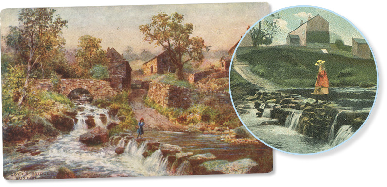
Above: This illustration, which appears on the cover of Gerald Hancock’s wonderful booklet on the valley, would have been painted around 1900. My thanks to Michael Baines for allowing me to scan some of his wonderful postcards of the Goyt Valley. They include an...
Aug 21, 2017 |
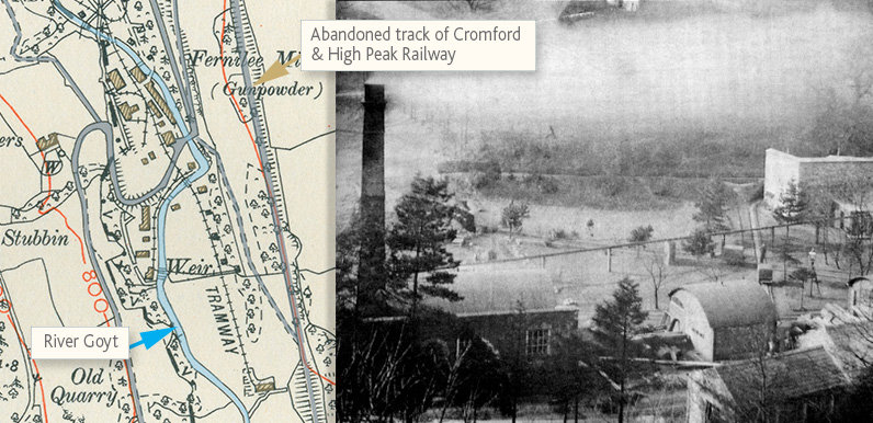
Above: The gunpowder mill once employed around 100 men. Today the ruins lie beneath the northern end of Fernilee Reservoir. Joyce published the 56-page, A5 booklet in 1996. For a signed copy, send a cheque for £8 made out to J Winfield, 13 Jodrell Meadow, Whaley...
Jul 6, 2017 |
Above: The old pump room has completely vanished! It was quite an eye-sore so I’m not sorry to see it go. And it means the footpath to Taxal has finally reopened. It’s taken almost a year, but the footpath between Fernilee and Taxal, past the old pump...
Jun 21, 2017 |
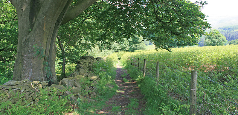
Above: This attractive footpath is at around point 9 on the map below. Above: The walk starts from the small carpark at the northern end of Fernilee Reservoir. (Click to enlarge.) I’ve just added walk 18 to the series: Fernilee Reservoir west bank. It’s...
Jun 15, 2017 |
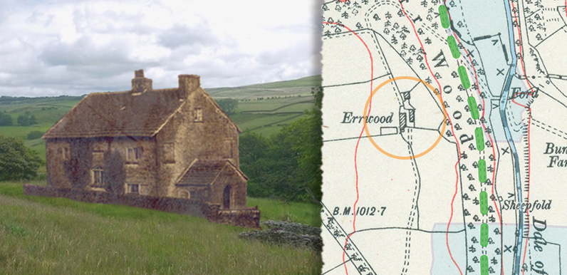
Above: George’s composite photo of Errwood Farm alongside an 1888 map. The blue areas are today’s twin reservoirs, and the green dashes show the old north-south route through the valley. Above: Click image to enlarge. My thanks to George for sending a...
