Detailed directions for all the walks featured on this website, each with step-by-step descriptions and photos, as well as a map, are now available to download as printable pdf files.
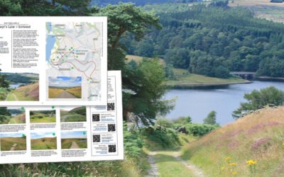
Detailed directions for all the walks featured on this website, each with step-by-step descriptions and photos, as well as a map, are now available to download as printable pdf files.
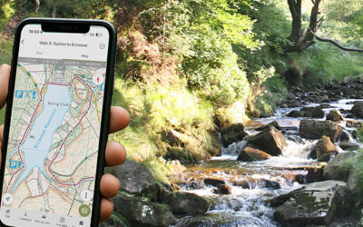
GPX files for all 30 walks in and around the Goyt Valley featured here are now available, with a step-by-step guide on how to install them on a walking app to find your way around a route.
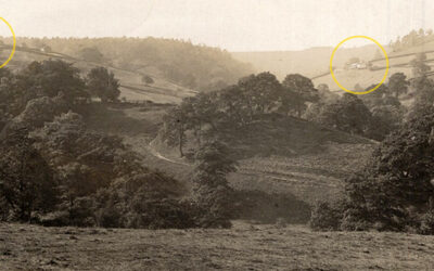
An early 1900s postcard view titled ‘Goyt Valley’ had me scratching my head trying to work out where it was taken. Members of the Goyt Valley Facebook Group came to the rescue.
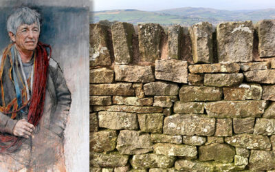
Celebrated local author Alan Garner has published a new book with a chapter explaining the dark background to his award-winning ‘Thursbitch’ novel and its links to the John Turner memorial stone.
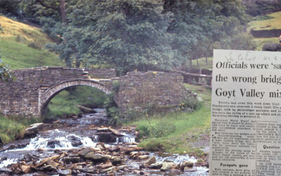
A recently discovered press clipping from 1964 reveals that the picturesque packhorse bridge that once lay in the heart of Goyt’s Bridge was very nearly lost due to an administrative error.
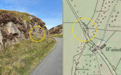
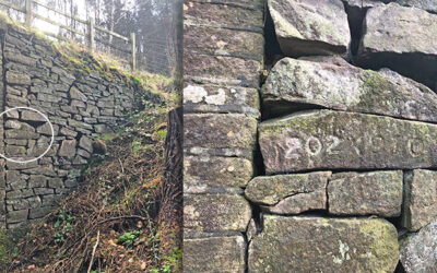
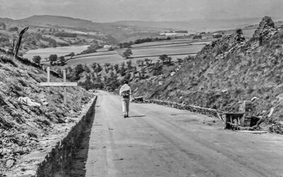
Two very weathered and roughly-carved religious phrases on the old Roman road lying close to the Goyt Valley could date back to when it was improved under a Turnpike Law passed in 1725.
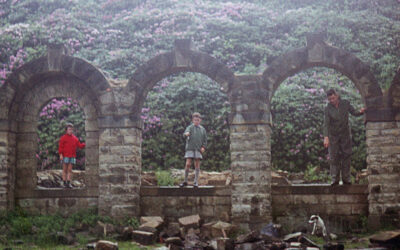
A series of family holiday snaps taken in the late 1950s and early ’60s, before the flooding of Errwood Reservoir, provide a unique view of both Errwood Hall and the packhorse bridge.
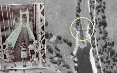
A recently discovered 1945 aerial photo of the southern tip of Fernilee Reservoir captures the metal suspension bridge which was removed in the mid ’60s, shortly before Errwood was flooded.
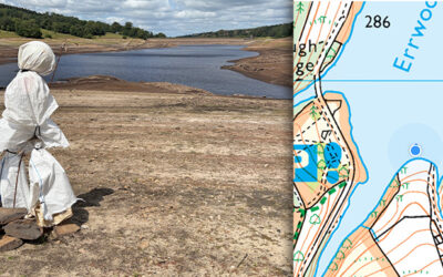
The ghostly figure of Bob looks out across Errwood Reservoir as the water level continues to drop dramatically. Will he be first to see Errwood Bridge appear above the surface. Time will tell…
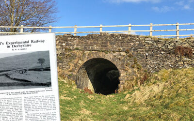
An obvious drawback with trains is that they can’t get up and down slopes. An experiment carried out in the Goyt Valley over 150 years ago tried to solve this problem.
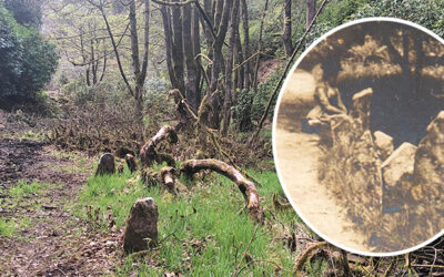
Forestry England has recently been clearing undergrowth from the old drive leading from Goyt’s Bridge to Errwood Hall, and it’s revealed some intriguing features alongside Shooters’ Clough.
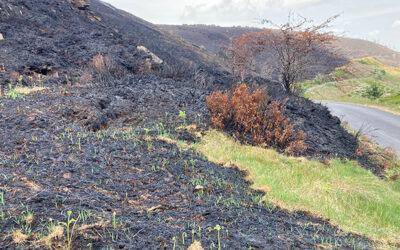
The green shoots of recovery are emerging from the devastation caused by the recent fire in the southern Goyt Valley. The cause is likely to have been a portable BBQ. They need to be banned ASAP.
Joe Brown’s Numbers is a 20-mile orienteering challenge around the Goyt Valley created by the famous climber in the 1960s. I’ve divided it into two more manageable walks with clues.
A recently discovered set of numbers are similar to those on Joe Brown’s orienteering challenge. But these point to Errwood Bridge, which now lies under Errwood Reservoir.
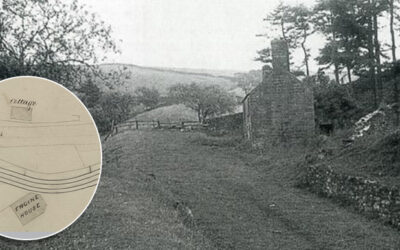
A grainy photo of a building half-way down the Bunsall Incline has always intrigued me. A recently discovered map from around 1855 shows it marked as a cottage, lying opposite a long-lost engine house.
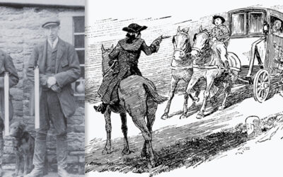
The Braddock family had worked for the Grimshawes since the building of Errwood Hall. So it was a surprise to learn that they were a tight-knit band of notorious highwaymen.
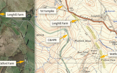
Many theories have been proposed for the mysterious, mile-long earthwork between Watford and Longhill Farms. Was it for a large gun, a railway test track, or perhaps an abandoned turnpike extension?
Some photos taken in 1967, shortly before the completion of Errwood Reservoir, including views along the Bunsall Incline as well as the suspension bridge which once spanned Fernilee Reservoir.
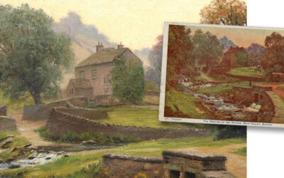
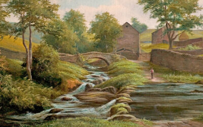
An original oil painting that appeared recently on ebay could be an early draft of my favourite postcard view of Goyt’s Bridge. The vendor gave me permission to sell copies to help fund this website.
Just discovered in Buxton Museum’s collection; a late 19th century oil painting showing the highly popular view of Goyt’s Bridge, over the stepping stones towards the packhorse bridge.
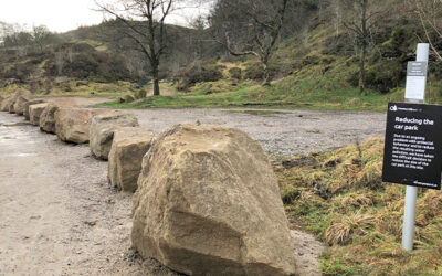
Forestry England has recently closed off the popular parking areas at Goytsclough with a long row of large boulders in an attempt to stop what they call ‘antisocial behaviour’.
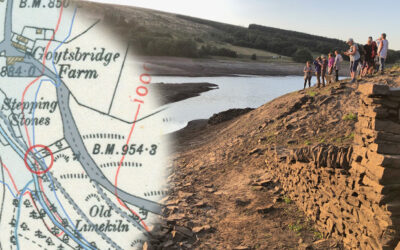
A photo taken back in late August 2022, when the water level in Errwood Reservoir dropped significantly, revealed the path running down to the second set of stepping stones.
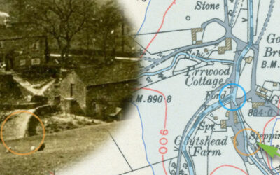
A 1918 photo taken from Goyt’s Lane towards Goytshead Farm comes frustratingly close to revealing a second set of stepping stones close to the packhorse bridge in Goyt’s Bridge.
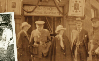
Four photos have been discovered of Goyt’s Bridge, taken by a Canadian nurse in 1918. They include both bridges as well as a wonderful view across the now-drowned hamlet.
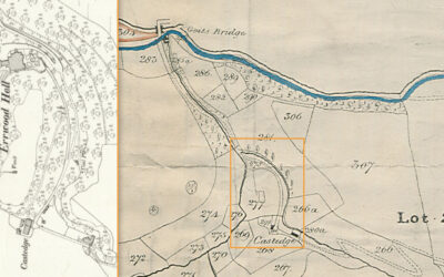
A detailed map published in 1832 for the sale of land in the Goyt Valley is the oldest I’ve seen. It must have been at this auction that Samuel Grimshaw purchased the land on which he’d build Errwood Hall.
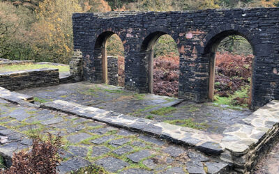
It’s good to see that the fencing around the ruins of Errwood Hall has finally been removed and visitors are again free to wander around this historic site. I just hope we can keep the vandals away.
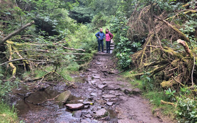
The mystery of the vanished footbridge along the path around the ruins of Errwood Hall deepens. I’m just hoping Forestry England will replace it. But their silence makes me fear for the worst.
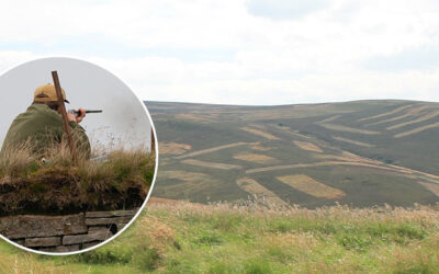
United Utilities has announced that they will ban grouse shooting in the valley from 2027, ending a sporting tradition which has taken place for centuries. The decision has caused a great deal of controversy.
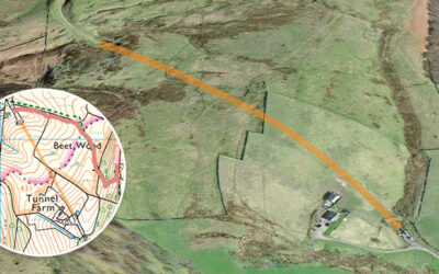
A couple of photos recently discovered on ebay show the southern end of the tunnel on the disused Cromford & High Peak Railway line being blocked off, probably sometime in the early ’60s.
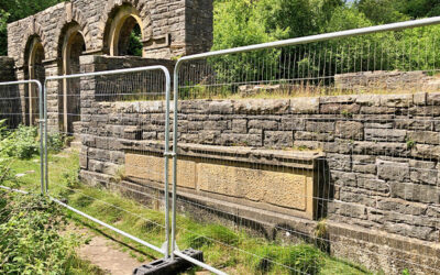
It’s sad to see that the recent spate of vandalism at the ruins of Errwood Hall has meant that they’ve now been fenced off for a couple of months whilst Forestry England make the necessary repairs.