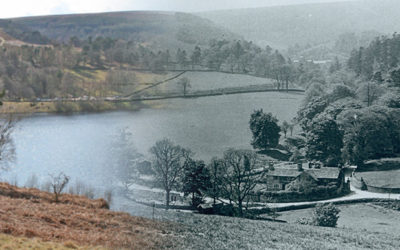
I’ve tried to match an old photo of the small hamlet of Goyt’s Bridge with today’s scene across Errwood Reservoir, and merge one over the other. It’s not perfect, but it’s fairly close.
I’ve tried to match an old photo of the small hamlet of Goyt’s Bridge with today’s scene across Errwood Reservoir, and merge one over the other. It’s not perfect, but it’s fairly close.
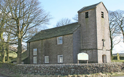
Looking isolated and forgotten, Jenkin Chapel has always intrigued me. It lies between Pym Chair and the village of Rainbow, and at the meeting point of three ancient trackways.