20. Three Shires Head
A detailed, step-by-step description and map of this walk are available to download for just £1.85. A walking app GPX file is also available at £1.50. Save on both for just £2.95. All proceeds help cover the hosting costs of this website.
Walk description…
Length: 5.1mls
Av. time: 2.20hrs
Ascent: 961ft
Start: Clough House car park
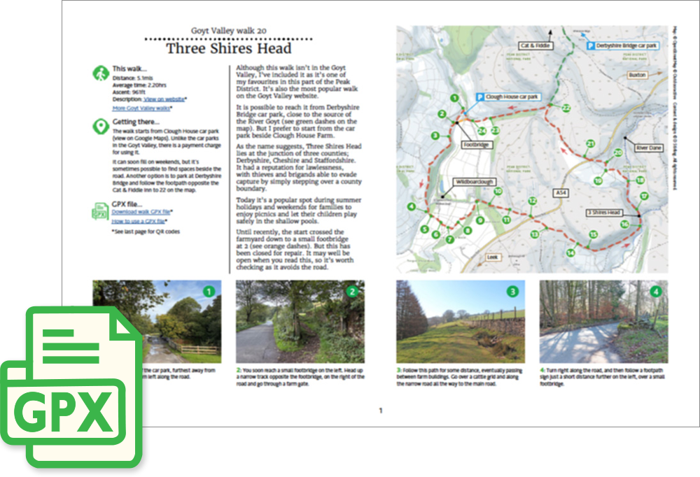
Although this walk isn’t in the Goyt Valley, I’ve included it as it’s one of my favourites in this part of the Peak District. It’s also the most popular walk on this website.
It is possible to reach it from Derbyshire Bridge car park, close to the source of the River Goyt (see green dashes on the map). But I prefer to start from the car park beside Clough House Farm.
As the name suggests, Three Shires Head lies at the junction of three counties; Derbyshire, Cheshire and Staffordshire. It had a reputation for lawlessness, with thieves and brigands able to evade capture by simply stepping over a county boundary.
Today it’s a popular spot during summer holidays and weekends for families to enjoy picnics and let their children play safely in the shallow pools.
Until recently, the start crossed the farmyard down to a small footbridge at 2 (see orange dashes). But this has been closed for repair. It may well be open when you read this, so it’s worth checking as it avoids the road.
‘Relive’ video…
Click to play. Click expand button to view in full screen.