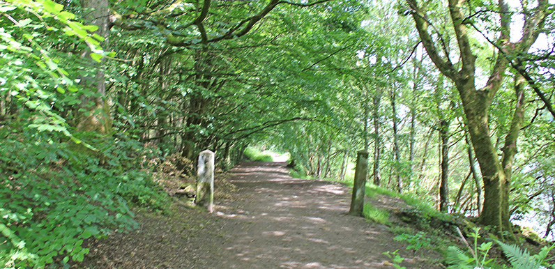
Above: The tree-lined path along the western shore or Fernilee Reservoir at point 4 on the map.

Click for a pdf with stage-by-stage details of the route including photos and a map, as well as links to car parks and public transport. A walking app GPX file is also available.
Length: 4.3mls | Av. time: 1.55hrs | Ascent: 371ft
Start: The Street car park | Google Map
Walk description, map & GPX | Download
A 4.3-mile circuit of Fernilee Reservoir – an easy stroll and a walk of two halves, through woodland on the western side and along a disused railway track on the other.
You can also often park at the northern end of the reservoir, near point 12 on the pdf map – just follow the signs down The Valentine from Fernilee on the Buxton to Whaley Bridge road.
There are several benches along the western shore with great views across the water, and an optional detour up the Woodland Walk.
The path along the western shore was once the main route from Goyt’s Bridge to the gunpowder mill, then up The Valentine to Fernilee and the Long Hill road. It may never have been a public route, as it ran through the mill – though no doubt the Grimshawes used it.
Along the Goyt
You could shorten the walk by crossing the dam at the northern end, but it’s worth going a little further, crossing the Goyt about half a mile downstream over a small footbridge.
Look out for the small footbridge at point 9 – one of the clues on the Joe Brown’s Numbers North course (walk 30) is inscribed beneath it, though you may need to get your feet wet to find it.
The riverbank path between points 9 and 11 reveals the picturesque landscape that was lost when the twin reservoirs were built – Fernilee in 1937, and Errwood some 30 years later.
The return follows the track of the old Cromford & High Peak Railway along the eastern shore. Beneath the water near the southern end lie the remains of a gunpowder factory that once employed over 100 men.
Click for a pdf with stage-by-stage details of the route including photos and a map, as well as links to car parks and public transport. A walking app GPX file is also available.
Route photos
Stages 1-6 of the route. Click any to enlarge and scroll through.
Relive video
Click to play and use the expand option to view in full-screen. More Goyt Valley Relives.