Nov 10, 2025 |
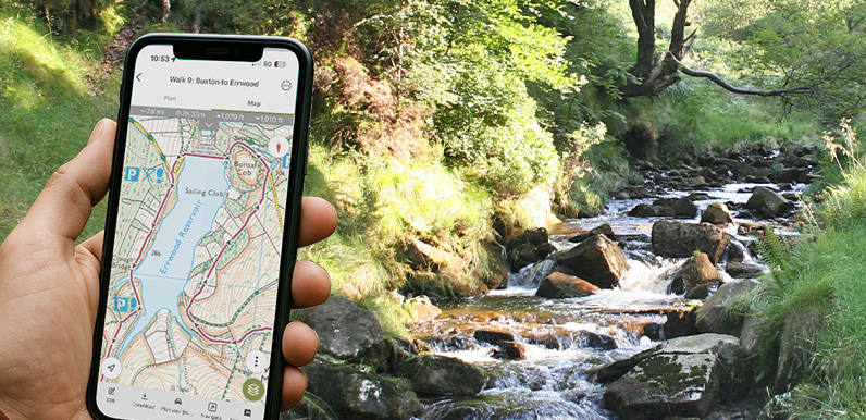
Above: Following the Buxton to Errwood Reservoir walk on OutdoorActive as it slopes down to the River Goyt. Using a GPX file An introduction to following a GPX route on a walking app, and some of the most popular apps available. Using OutdoorActive A detailed guide on...
Oct 27, 2025 |
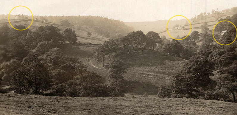
Above: I’ve circled the three farmhouses which helped pinpoint where the photographer would have been standing. Knipe Farm is hidden behind the trees in the centre. Above: This is the full image. Click to expand. Ebay is a wonderful source for old postcards...
Oct 22, 2025 |
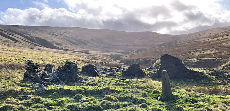
Above: The evocative ruins of Thursbitch Farmhouse lie below the ridge between Pym Chair and Shining Tor. Above: Jenkin Chapel lies just a mile or so west of the twin reservoirs and is well worth a visit. Click here to read more about its rich history. Published in...
Oct 17, 2025 |
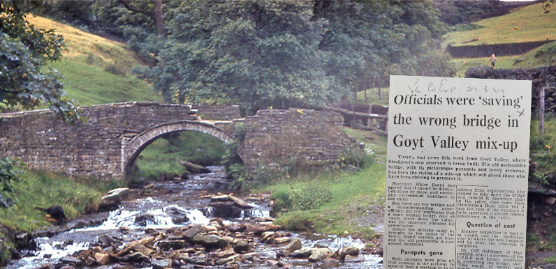
Above: The packhorse bridge was already showing signs of damage when this photo was taken in July 1960. Many thanks to John Bingham on the Goyt Valley Facebook Group for posting a couple of press clippings he discovered in Derbyshire Record Office. They reveal that...
Oct 10, 2025 |
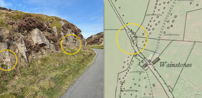
Above: The two religious phrases are crudely inscribed on the left of the cutting as the old Roman road heads north towards Whaley Bridge. The map on the right dates to the early 1900s and shows how close the cutting lay to the Wainstones. Christine recently posted a...
Aug 11, 2025 |
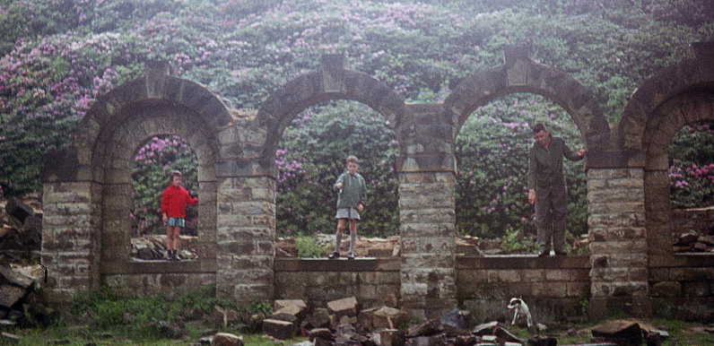
Above: The ruins of Errwood Hall pictured in May 1964, more than 30 years after the house had been demolished. The arches were to the right of the front entrance (see this image). I think they were taken down in the early 1970s, which is a great shame. The Goyt Valley...
Aug 5, 2025 |
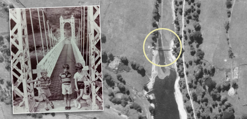
Above: The aerial photo was taken in August 1945. It’s looking south so the southern end of Fernilee Reservoir is at the bottom of the frame. The inset photo of three children dates to the 1960s, shortly before the bridge was removed. The fade below shows where...
Jul 7, 2025 |
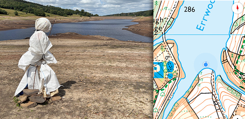
Above: Bob looks out across a very low level Errwood Reservoir. The blue dot on the map shows where he normally stands, just below the water line. At the time of writing in early July 2025, the water level in Errwood Reservoir is the lowest I’ve seen it, and...
Jun 8, 2025 |
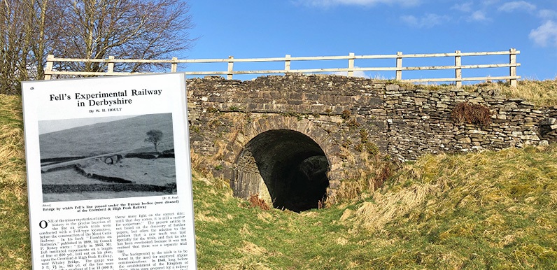
Above: The route of Fell’s experimental railway has never been revealed by any archeological evidence, but many believe it ran through the tunnel underneath the Bunsal Incline. Above: Railway engineer and inventor, John Barroclough Fell. I recently posted about...
Jun 5, 2025 |
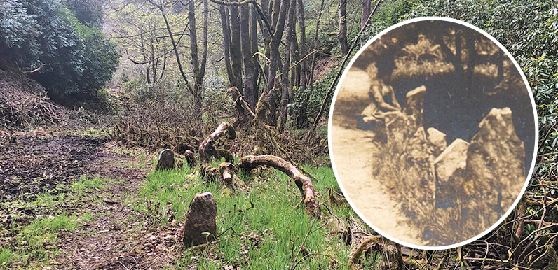
Above: The recent clearance of the drive has revealed a series of upright stones bordering Shooters’ Clough. The early 1900s postcard below shows a lady sat between some of those same stones. At the time of writing, in early June 2025, the water level in Errwood...


